I drove into my best hayfield
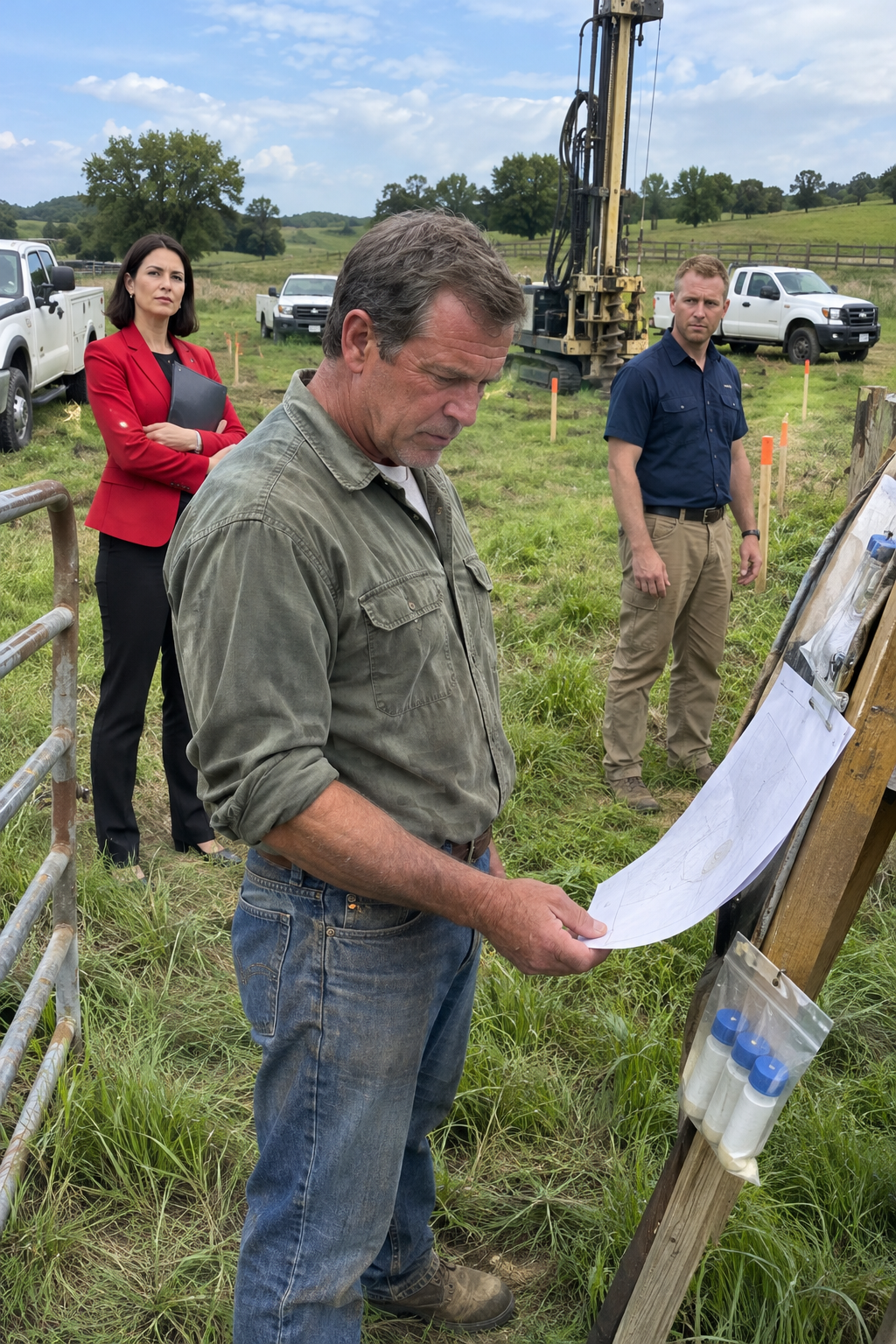
I drove into my best hayfield and found the HOA supervising a drilling crew for a cell tower I had never approved, but one number on their site plan told me the trouble had begun long before those trucks arrived….
I was 54 that summer, and I knew every rise and low spot on my ranch. The South Hayfield wasn’t a pretty patch of grass I kept for the view. It was working ground, with deep soil and just enough moisture near the creek to give me two good cuttings in a favorable year. What happened there affected how the ranch paid its bills.
The hayfield sat behind an old gate on a fence line that had been there before the subdivision went in next door. Over the years, the new neighborhood acquired smooth roads, stone entry signs, ornamental trees, and a homeowners association. I never had much to do with the HOA. Its property ended where mine began, and I figured that was a perfectly good arrangement.
Then one morning I came down toward the South Hayfield and saw three utility trucks parked inside my gate. A drilling rig stood in the grass, and orange paint and wooden survey stakes outlined a broad square where my best hay normally grew. Fresh tire tracks ran straight across the field. These people had not stopped to ask permission or even check whether they had crossed the right fence.
Near the trucks stood a woman I recognized from the HOA board. She was about 41, tall, with dark hair just above her shoulders and a sharp, composed expression. Her bright red blazer looked wildly out of place beside a soil-testing crew in rolled-up work sleeves. She held a folder against her side and watched the operation as though she had every right to be there.
I didn’t rush up and start shouting. I walked around the outside of the staked square to understand what I was seeing. The flags continued toward the southeast corner, where a route had been marked back toward the subdivision road. One truck belonged to an engineering contractor; another carried telecommunications equipment. Plastic sleeves for soil samples lay beside the rig.
I’d seen enough land projects over the years to recognize that sequence. First someone marks the ground and checks access. Then comes a drill, followed later by excavation, concrete, and something that stays put. This was not a neighbor measuring for a fence, and the crew wasn’t wandering around looking for a lost utility line. They were preparing a site.
The woman in red had a drawing clipped inside her folder. From where I stood, I could make out a narrow access lane from the subdivision, a rectangular lease area beyond it, and a circular mark in the middle. That circle told the story: a communications tower. Somebody had selected a piece of my hayfield for a commercial facility, and the work had already advanced past the talking stage.
That changed what I needed to know. A few misplaced stakes could be pulled out; a contractor on the wrong side of a fence could be sent home. A cell tower, though, meant a long-term agreement, access for maintenance, utility lines, foundations, and people coming back for years. Someone had assured the company that the ground was available, or those trucks would not have been there.
The HOA did own land near my eastern boundary. There was a narrow strip of common property along part of the subdivision road, along with drainage and landscaping areas farther inside the development. I had no complaint about the association using what it actually owned. But its strip wasn’t my South Hayfield, and nobody had ever asked me to lease the land beyond it.
I paid the taxes on that field. I insured it with the rest of the agricultural acreage, maintained the fence, mended the gate, and cut the hay. My ranch deed covered the ground where the rig was parked. The HOA could no more grant a lease on my field than I could grant a lease on somebody’s house in its subdivision. Yet the board member acted as if the question had already been settled.
Before talking to anyone, I looked at a weatherproof packet clipped to a temporary project board. It held contractor instructions, a little parcel diagram, and several site references. Most of the printed numbers meant nothing to me. One of them, however, had a familiar pattern: the parcel identification number.
I had seen that sequence on my annual tax statement and on the ranch insurance papers. I didn’t have every digit memorized, so I took pictures instead of relying on my memory. The number sat beneath the tower drawing, connecting the proposed lease site to a specific tract of land. If I was recognizing it correctly, somebody had put my parcel into the deal.
I looked back at the drilling rig, then at the woman with the red blazer. What bothered me most was how certain everyone seemed. They had arrived with equipment, stakes, a drawing, and work orders. None of that happened just because somebody casually pointed at a field one afternoon. A paper trail had brought them to my gate, and I wanted to see where it started.
I headed back to the house rather than turn it into a shouting match. From the yard I could still see the rig through the cottonwoods, though the crew’s work had slowed. In my office I pulled open the cabinet where I kept tax notices, closing papers, insurance renewals, old surveys, and the maps I’d saved whenever a fence needed repairing. I started with the most recent county property tax statement.
There was the parcel number near the top of the page. I set my photograph beside it and checked the digits carefully. They matched. The county statement described the agricultural tract that included the South Hayfield—the same ground now marked for a cell tower. I checked the insurance schedule next, and it listed that parcel as ranch acreage too.
For a moment I just stood at the table with the papers spread out in front of me. This wasn’t simply a survey crew following an inaccurate set of directions. My parcel number had appeared in a commercial project whose paperwork treated the HOA as the party granting access and lease rights. Someone had taken an association’s limited control near my boundary and turned it, on paper, into control over my field.
The trucks could leave by supper and the paint could wash off in a few weeks. A signed lease tied to the wrong parcel was another matter entirely. I had found the first hard contradiction: my tax and insurance records identified the land as mine, while a tower project was proceeding as though the HOA could rent it out. What I didn’t know yet was how far that false assumption had traveled. Part 2…..
I started by laying an old county parcel map beside the tax statement. It showed my agricultural tract extending toward the subdivision and the HOA’s narrow common strip following the road on the other side of the boundary. The strip was real, and that mattered. It explained why a tower company might have approached the association for access in the first place.
What it did not explain was the tower pad. When I compared the map with photographs of the site drawing, the route began at the subdivision road, passed over association-controlled ground, then kept going past the line into my hayfield. The proposed square was well beyond that boundary. This wasn’t a fence misplaced by two feet; the entire working area was on the wrong property.
I opened the county assessor’s online map to compare it with my paper copy. The same two parcels appeared: the larger ranch tract and the little common-property strip. Aerial photos made the open land look continuous, especially where the strip widened near a corner. I could understand how a preliminary scout might confuse the view from above. I could not understand why a lease had been prepared without checking the deed.
By late afternoon the drilling rig had left, though orange markings and stakes remained in the grass. That gave me room to research without machinery running in the background. I printed the county map, marked where the rig had stood, and turned to the subdivision’s recorded documents. If the association had acquired more land than I realized, those records should show it.
The first plat showed roads, lots, drainage features, and common areas. Later amendments and the recorded conveyance to the HOA told the same story. The association had received certain defined strips and other common property inside the development. It had not received a piece of the South Hayfield, and the dividing boundary was marked in the older records as well as the modern map.
I checked the infrastructure papers from the neighborhood’s construction years. They described limited access and utility arrangements connected to building the subdivision. They did not transfer the adjoining ranch to the HOA or give it permanent rights to build a telecommunications facility there. I could see how access along the road might have been mistaken for control over the land beyond it. Access and ownership were two different things.
I returned around noon the following day and saw the woman in red again. This time she was beside a black SUV near the subdivision entrance, wearing dark sunglasses and going through papers on the hood with a contractor. The rig was gone; nobody was drilling. Still, the way she stood over those papers made the site look delayed rather than abandoned.
I photographed the crossing where the marked access route left the association strip. Then I went back to the house for my ranch deed, an older survey, and the subdivision plat. The deed’s legal description was full of courses, distances, and references, but following the eastern boundary was worth the effort. Its line agreed with the older survey and the subdivision documents. There was no hidden HOA parcel around the proposed tower site.
A local title professional familiar with agricultural land reviewed the documents I collected. The preliminary answer agreed with mine: the HOA owned the roadside common strip, while my deed covered the hayfield. We also looked for another recorded right that might explain the project, such as an easement, prior lease, or utility interest allowing the association to occupy the footprint. Nothing we found gave the HOA that right.
Then I searched public land records using the telecommunications site identifier photographed from the contractor packet. That search turned up what the project-name search hadn’t: a memorandum of lease, recorded weeks before the trucks arrived. It named the HOA as the party granting lease rights, referred to the proposed communications site, and carried the parcel identification number of my ranch. I had never signed a lease.
The memorandum wasn’t the complete agreement, and its appearance in the county record didn’t prove the HOA owned anything. A recording office accepts documents for filing; it doesn’t settle ownership disputes by filing them. But now there was a document in the public record associated with a lease affecting my parcel. Even if the drilling stopped, that document could cause trouble until it was properly released or corrected.
I set the memorandum beside my recorded deed. One document showed the owner. The other showed who had behaved as though they were the owner. I had started the week concerned about stakes in my hay. Now I was dealing with a paper claim that had already reached the public land records, and I needed to find out whether the permitting office had relied on it too.
Part 3 The county’s planning and permitting file already contained a tower application. I found site drawings, access information, engineering materials, and paperwork presenting the applicant as having adequate authorization to pursue that location. My parcel number appeared there again. An error that may have begun with an aerial sketch had been repeated through a lease memorandum and into a government review process.
The permitting office wasn’t supposed to decide who won a land-title dispute. But the proposed site couldn’t be evaluated as if the claimed right to use it were undisputed after I supplied the conflicting deed and other records. I gathered the relevant pages and requested that the ownership and site-control issue be considered. I also hired a licensed surveyor so the boundary would not rest on my own measurements.
The surveyor reviewed the ranch deed, older survey, subdivision plat, and HOA common-property information before checking the ground. Existing monument references helped locate the recorded line. The survey placed the proposed tower footprint clearly inside my ranch, not on the common strip and not on a marginal boundary. The access path began on HOA-controlled land, crossed the line, and ended where the association held no documented right to build.
I submitted the deed and survey findings to the county process. The result was limited but important: the claimed site control was no longer being treated as uncontested. The project could not keep progressing at that location without proof of valid rights to the land it proposed to occupy. The review slowed and the site stopped advancing. No one had needed to declare a winner in the permitting office to recognize the missing authorization.
That triggered the more consequential review inside the telecommunications company. Its people compared the lease materials and recorded memorandum with the parcel number, deed, subdivision documents, and survey. They were looking beyond the question of whether a road could reach the site. A permanent tower needed the right to occupy its pad, install utilities, construct and maintain equipment, and enter for years afterward.
The HOA could offer some rights along its own common strip. It couldn’t offer rights over the tower footprint, because it didn’t own that ground. Changing a number in the paperwork would not move the tower. Nor could the old subdivision infrastructure documents turn a temporary or limited use right into permission for a commercial facility on the neighboring ranch.
I later saw a county application document connecting the submission to HOA board approval dated before the drilling equipment ever arrived. It didn’t tell me who first typed the wrong parcel number, so I never claimed to know. It did show that the project had been approved and advanced with my parcel already connected to it. The mistake had survived several opportunities for somebody to check the underlying property records.
The woman in the red blazer kept appearing near the subdivision entrance in her black SUV, with a folder or tablet in hand. But there was a visible difference. At first she had stood inside my gate watching a rig work on the hayfield. Now she stood by the road while survey and title records determined what the project could do. The contractors did not come back to finish the soil investigation.
The telecommunications company put the site on hold. Engineering for that location stopped advancing, and no foundation package went forward for construction. A project that had already used the time of engineers, survey crews, site-acquisition workers, permit preparers, and contractors was now stalled by an elementary question: who had the right to lease the ground beneath the tower?
That also had consequences for the HOA. The agreement had been treated as a potential source of long-term association revenue. But work had already been commissioned and expenses incurred, while the land behind the deal was unavailable on the terms the board had signed. I never saw all the invoices, and I couldn’t say which organization would pay each one. Those questions depended on contracts I wasn’t a party to.
Eventually the company concluded that the existing HOA agreement could not reliably support a tower at the South Hayfield site. It could search for a different location, but that would require fresh site selection, access analysis, engineering, lease documents, and permitting. Or it could seek legitimate rights from me. After contractors had come through my gate without permission and a lease memorandum had been recorded against my parcel, I had no interest in saving the arrangement.
What I wanted was straightforward. I wanted the proposed tower off the hayfield, the county file closed for that location, and the misleading lease memorandum cleared from my property record. The last demand was the one I kept pressing. A drilling rig can drive away in an afternoon, but an old document in a land-record search can keep raising questions long after the grass grows back.
Final The resolution came through paperwork instead of a confrontation. The telecommunications company stopped pursuing the South Hayfield location because its agreement with the HOA did not provide reliable rights to the proposed tower footprint. The association still owned its common strip and other subdivision property. It simply had no authority to lease my field as the tower site.
The drilling equipment never returned. There was no poured foundation, no permanent tower access road cut through my hay, and no communications structure rising over the pasture. As the abandoned site was cleared, most of the survey stakes were removed. I photographed the remaining marks before pulling a few loose stakes left behind, and the orange paint eventually faded under the summer sun.
Clearing the public record took longer. I wasn’t satisfied with a phone call saying the project was dead while the recorded memorandum still referenced the ranch parcel. The title professional helped keep attention on the recorded instrument until the parties to the tower deal prepared a release, termination, or corrective filing. The necessary document was recorded, removing the appearance of an active lease interest from that failed transaction.
That filing did not give me the land. The deed had already established my ownership, supported by the older survey and the subdivision’s own recorded boundary. What the new filing did was clear away a transaction made by someone without the rights the tower footprint required. The county application for the proposed location was closed or withdrawn rather than approved.
There were financial consequences I could see without pretending I knew everyone’s accounts. Engineering, survey work, early soil testing, site acquisition, permitting, and expanded title and legal review had all consumed time and money. Which party absorbed those expenses was governed by the agreements among the HOA, tower company, and contractors. I never got a full accounting, and it wasn’t necessary to protect the ranch.
The HOA also had to reckon with how a real estate commitment had moved so far without proper ownership verification. Future association property deals received more scrutiny of legal descriptions and land rights before commitments were made. That was a more useful outcome than any public argument. A simple boundary check early in the process could have spared everybody a great deal of trouble.
I still caught sight of the woman in the red blazer near the neighborhood from time to time. The dark hair, black SUV, and tidy folder were familiar, but she didn’t stand inside my gate again. I didn’t damage equipment, block roads, or threaten the board. The deed, survey, permitting review, and release of the recorded memorandum did more than an angry scene ever could.
By late summer the South Hayfield looked like a hayfield again. Tire tracks disappeared, the disturbed soil greened over, and I cut hay where the rig had once stood. From the tractor seat, there was little sign that a cell tower had almost been built there under an agreement signed by a party that did not own the site.
I kept everything in one folder: the tower exhibit, parcel number, tax record, plat, deed, survey, permit materials, lease memorandum, and the document that cleared it. I wanted the facts to outlast anyone’s version of the story. The HOA had started with a legitimate narrow strip of land; the mistake was acting as though that strip gave it control over everything beyond. One parcel number forced a closer look, and the actual boundary held.
THE END. I’ve shared the complete story, and I truly hope it touched your heart. If this story moved you, please , like, and share the post. Thank you for reading! ❤️
✓ Lynn R. Adams
I drove into my best hayfield and found the HOA supervising a drilling crew for a cell tower I had never approved, but one number on their site plan told me the trouble had begun long before those tru…