I Bought a Lake Cabin Beyond the HOA’s Reach—Then Their Only Road Became Mine, and the Neighborhood’s Biggest Secret Came Knocking
I Bought a Lake Cabin Beyond the HOA’s Reach—Then Their Only Road Became Mine, and the Neighborhood’s Biggest Secret Came Knocking
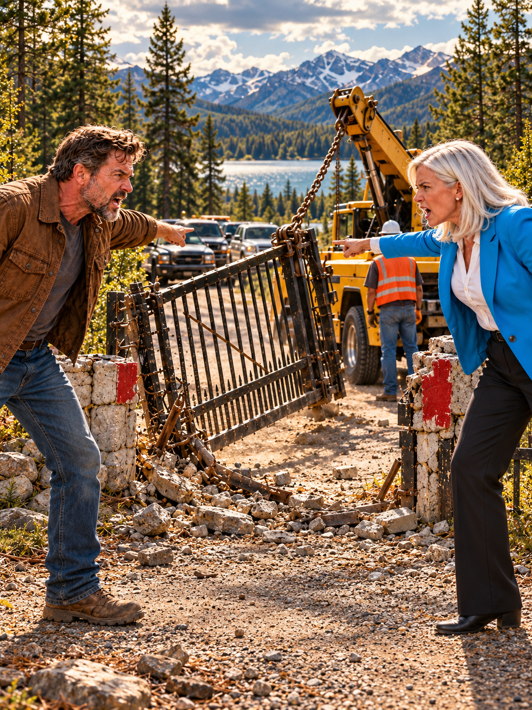
The first thing the HOA president did after discovering that I owned the only road into her lakefront community was send a tow truck to drag my truck off my own property.
The second thing she did was call the sheriff and tell him I had stolen a road that had belonged to her family for forty years.
She made one mistake.
She assumed I was the kind of man who would panic when a woman in a designer blazer pointed a finger at him.
My name is Daniel Carter. I was forty-one years old when I bought the cabin, and by the time that summer ended, I would discover that the road was worth millions, the HOA president had been lying to her neighbors for years, and someone had buried a secret beneath the pavement that could destroy everyone involved.
But I’m getting ahead of myself.
Three months earlier, I had been living in a two-bedroom rental outside Knoxville, Tennessee, trying to figure out what to do with a life that had become smaller than I ever imagined.
My marriage had ended two years before. My father had died the previous winter. The construction company I had spent fifteen years building had been sold after a financial dispute with my former business partner, leaving me with enough money to start over but not enough desire to do it in the same place.
I wanted quiet.
Not the kind of quiet you find in an expensive gated subdivision, where every lawn looks identical and somebody eventually complains if your trash can sits beside the garage for twenty minutes too long.
I wanted real quiet.
Pine trees. Cold water. A porch where I could drink coffee without hearing traffic. A place where nobody knew my name and nobody cared what I did with my weekends.
That was how I found the listing.
The cabin sat on the northern shore of a long, blue lake in rural eastern Tennessee, about forty minutes from the nearest grocery store. It had a rusted tin roof, weathered cedar siding, a stone chimney, and a dock that leaned toward the water as if it were tired of holding itself upright.
The listing described it as a fixer-upper with limited access.
The photographs showed a sagging porch, a kitchen with yellowed cabinets, and a narrow gravel road winding through thick woods.
The price was $189,000.
I knew enough about construction to recognize a bargain when I saw one. The cabin needed work, but the foundation was sound. The roof could be repaired. The electrical system was old but manageable. The shoreline was beautiful.
And there was something else.
The property description included a phrase that made me read it twice.
“Private access road conveyed with property, subject to recorded easements.”
I called the real estate agent.
“How private is the road?” I asked.
She paused.
“That depends on what you mean.”
“I mean who owns it.”
“The seller owns the cabin and the road parcel. There’s a homeowners association farther south along the lake, but the cabin isn’t part of it.”
“Does the HOA use the road?”
“Some of its residents do.”
“Do they have an easement?”
“That’s something your attorney would need to review.”
That answer should have made me cautious.
Instead, it made me curious.
I hired a local title attorney named Rebecca Shaw. She examined the deed, the recorded plats, and the easement documents. She also ordered a survey because the property lines had not been properly marked in years.
Two weeks later, she called me.
“The road parcel is included,” she said. “The recorded documents grant access to several properties, but the easement language is narrower than I expected.”
“How narrow?”
“There’s a defined route, a maintenance provision, and a list of benefited parcels. The HOA itself doesn’t own the road. Its members may have certain access rights, depending on the exact location and the terms of the easement.”
“So the association can’t simply tell me what to do with it?”
“Not automatically. But don’t confuse ownership with unlimited control. Existing easements still matter, and there may be other restrictions we haven’t uncovered.”
I appreciated her honesty.
I wasn’t buying a weapon to use against anyone. I was buying a cabin.
Still, I asked her to finish the review before I signed.
Three days later, she sent me a message.
The title was clear enough to proceed, subject to the listed easements and the survey confirmation.
I closed on the property on a rainy Thursday morning.
The seller, an elderly man named Walter Briggs, shook my hand outside the attorney’s office.
“You’re going to like it up there,” he said.
“That’s the plan.”
He glanced toward the parking lot, then lowered his voice.
“One piece of advice, Daniel.”
“What’s that?”
“If somebody from the lake association tells you that you owe them something, ask them to show you the document.”
“Sounds reasonable.”
Walter didn’t smile back.
“No. I mean it. Ask them to show you the document. Not the newsletter. Not the map they printed themselves. The actual document.”
Before I could ask what he meant, he climbed into his old pickup and drove away.
I watched him disappear into the rain.
Then I drove to my new home.
The road began at a county-maintained gravel lane and climbed gently through a forest of oak, pine, and maple. About half a mile in, it forked around a low stone wall. One branch continued north toward my cabin. The other curved south toward a collection of expensive lake houses with immaculate lawns and private docks.
At the fork stood a wooden sign.
CEDAR HOLLOW LAKE COMMUNITY
Beneath it, someone had attached a smaller white plaque.
PRIVATE ROAD — AUTHORIZED RESIDENTS ONLY
I stopped the truck and examined the sign.
The road was on my parcel, but that didn’t necessarily mean every sign or every restriction was unlawful. There could be valid easements, local rules, or recorded agreements to consider.
I took photographs of the sign and the surrounding property.
Then I continued to the cabin.
The first night, I slept on a mattress on the living room floor because the bedroom floorboards needed replacing.
Rain tapped against the tin roof.
The lake moved in the darkness beyond the windows.
For the first time in two years, I woke up the next morning without an alarm, a meeting, or a phone call from somebody demanding that I solve a problem they had created.
I made coffee on a portable burner and sat on the porch.
It was almost perfect.
Then a black SUV appeared on the road.
It stopped beside my mailbox.
A woman stepped out wearing white trousers, a navy blazer, and sunglasses that looked more expensive than my first car.
She studied the cabin as though she had arrived to inspect a property that belonged to her.
Then she looked directly at me.
“Are you Daniel Carter?”
“I’m Margaret Whitmore, president of the Cedar Hollow Homeowners Association.”
She said it like a title that should have made me stand up.
I remained seated.
“Nice to meet you.”
Her eyes moved over the porch, the unpainted trim, and the stack of lumber beside the steps.
“You’re planning to renovate?”
“Eventually.”
“Before you do anything, you’ll need to understand the community standards.”
I set down my coffee.
“This property isn’t part of your community.”
Her smile tightened.
“Technically, no. But your access road is essential to our residents, and we have an established set of expectations concerning its appearance and maintenance.”
“Do you have a recorded agreement with the property?”
She blinked once.
“Excuse me?”
“An agreement that gives the HOA authority over the road.”
“We’ve used it for decades.”
“That’s not what I asked.”
Margaret removed her sunglasses.
She had pale blue eyes and the practiced expression of someone accustomed to getting agreement before anyone had time to ask questions.
“Mr. Carter, Cedar Hollow is a private community. Our residents pay substantial dues to maintain the quality of life here. We can’t have an outsider making unilateral decisions that affect everyone.”
“Then perhaps your association should have purchased the road.”
Her expression changed.
Only slightly.
But I saw it.
She had expected resistance, perhaps, but not that answer.
“This conversation is going to be more complicated than it needs to be,” she said.
“Only if we make it complicated.”
She placed a thick envelope on the porch railing.
“These are our access policies. Please review them before making any changes to the property.”
I didn’t touch the envelope.
“Are they recorded?”
“They’re community policies.”
“That’s not the same thing.”
Margaret stared at me for several seconds.
Then she picked up the envelope and walked back to her SUV.
At the driver’s door, she turned.
“People who move to Cedar Hollow usually discover that cooperation is much easier than confrontation.”
I raised my coffee.
“Have a nice day, Margaret.”
She drove away without responding.
I watched the SUV disappear behind the trees.
Then I called Rebecca.
“Do you remember the HOA we discussed?”
“Unfortunately.”
“How much trouble would it cause if its president decided she owned my road?”
Rebecca was quiet for a moment.
“Has she actually claimed that?”
“Not in those words.”
“Then document everything. Don’t block anyone. Don’t change the road. Don’t interfere with any established access rights. And don’t sign anything she gives you without sending it to me.”
“That’s what I wanted to hear.”
“People don’t usually drive up to a stranger’s house to explain rules they know they can’t enforce.”
I looked toward the road.
“That was my impression.”
“Be careful.”
I promised I would.
Then I went back to repairing the cabin.
For the next week, I saw no one from Cedar Hollow.
I replaced rotten porch boards, cleared fallen branches, and repaired the dock. I found a hardware store in the nearest town and became friendly with the owner, a broad-shouldered former mechanic named Earl Dawson.
When I mentioned the HOA, Earl stopped counting the screws I had brought to the register.
“Margaret Whitmore?” he asked.
“That’s the one.”
He shook his head.
“Well, now.”
“What does that mean?”
“It means you should keep your paperwork dry.”
“That woman has been trying to get her hands on every strip of land near that lake since her husband died.”
Earl glanced toward the store window.
“Depends on who you ask.”
“I’ll ask you.”
He leaned against the counter.
“Her husband, Richard, was a developer. Built half the houses down there. After he died, Margaret took over the association. She’s been pushing for a second entrance, a private marina expansion, and a new access corridor for years.”
“Is there a problem with the current entrance?”
“Not unless you’re trying to build something bigger than the county road can handle.”
I thought about the fork in the road.
“The access road on my property?”
Earl nodded.
“That road is the reason Cedar Hollow can get to the northern side of the lake without making a long loop through the county roads. If you own it, you’ve got something she wants.”
“An easement doesn’t give her ownership.”
“No,” Earl said. “But if she can convince enough people that it does, she might not need ownership to make your life miserable.”
I bought the screws and left.
On the drive home, I began to understand why Walter Briggs had warned me.
Still, I wasn’t worried.
I had the deed, the survey was underway, and Rebecca was a phone call away.
I had no intention of interfering with legitimate access.
All I wanted was to live in my cabin.
Unfortunately, Margaret Whitmore had no intention of letting that happen.
The first notice arrived on a Monday.
It was taped to my front door in a clear plastic sleeve.
NOTICE OF NONCOMPLIANCE — CEDAR HOLLOW COMMUNITY ACCESS REGULATIONS
The document accused me of maintaining an unsightly property, allowing unauthorized vehicles onto the private access corridor, and failing to comply with road maintenance standards.
At the bottom, it demanded payment of a $2,500 administrative fee within ten days.
I read it twice.
Then I photographed it, placed it in a folder, and sent it to Rebecca.
Her response came five minutes later.
“Do not pay. Do not acknowledge any contractual obligation. I’ll send a formal response.”
The next morning, another notice appeared.
This one demanded that I remove the old dock because it allegedly violated Cedar Hollow’s shoreline aesthetics policy.
The dock had been built decades before Cedar Hollow existed.
I knew that because Walter had shown me a photograph of the original cabin from the 1970s, with the same dock stretching into the water.
I sent the notice to Rebecca.
She replied with one sentence.
“She is testing whether you understand the difference between a demand and a legal obligation.”
I printed the sentence and placed it beside the notices.
Then I went back to work.
For several days, nothing happened.
I began to think Margaret had decided to retreat.
Then, at on Friday morning, a tow truck pulled onto my property.
I heard the diesel engine before I saw it.
I stepped outside in jeans and an old gray T-shirt. The driver was already backing toward my pickup.
“Can I help you?” I called.
He lowered his window.
“Got an order to remove this vehicle.”
“From whom?”
“Cedar Hollow HOA.”
I stared at him.
“The truck is parked on my land.”
He checked his clipboard.
“Lady said it’s obstructing a private access lane.”
“It’s in my driveway.”
“I don’t know anything about that. I just have the work order.”
I walked toward the tow truck, keeping my hands visible.
“Show me the order.”
He hesitated, then handed me a sheet of paper.
The top bore the HOA’s name. The bottom had Margaret Whitmore’s signature.
There was no court order, no law enforcement authorization, and no document establishing that the HOA could tow vehicles from my driveway.
I took photographs of the paper.
“You’re not removing the truck,” I said.
The driver frowned.
“Look, man, I don’t want trouble.”
“Neither do I. But if you tow my vehicle from my property without lawful authority, you may create a problem for yourself and your employer.”
He looked at the paper again.
“She told me she had authority.”
“Then she can show it to you.”
I called the towing company’s office and asked to speak to a manager. I explained the situation calmly and provided the property address.
The manager told the driver to stand down.
The tow truck left.
I had just started making coffee when my phone rang.
An unfamiliar number appeared on the screen.
“Mr. Carter?” a man asked.
“This is Deputy Lewis with the county sheriff’s office. We received a complaint that you’re obstructing an established community road.”
“Where are you now?”
“At the Cedar Hollow entrance. The HOA president is here.”
“Would you like me to meet you at the property?”
“That would be helpful.”
I drove down the road.
Margaret stood beside the wooden community sign, arms folded. Three residents waited behind her, including a gray-haired man in a golf shirt and a younger woman holding her phone as if she were filming a documentary.
Deputy Lewis stood near his patrol vehicle.
He looked relieved when I arrived.
“Mr. Carter, Ms. Whitmore says you’ve blocked residents from using the access road.”
“I haven’t blocked anything.”
Margaret stepped forward.
“He’s been threatening residents and attempting to impose unauthorized restrictions on a road our community has maintained for decades.”
“Which restrictions?” I asked.
“Your refusal to recognize our access authority.”
“That’s not a restriction. That’s a disagreement.”
Deputy Lewis held up one hand.
“Let’s keep this civil. Do you own the road parcel?”
“Yes. Here’s the deed, and here’s the recorded survey showing the relevant parcel boundaries.”
I handed him a folder containing copies of the documents.
He studied them.
Margaret’s mouth tightened.
“Those documents don’t erase decades of established use.”
“Nobody said they did,” I replied. “Any valid easement remains subject to its actual terms. I haven’t blocked the road, and I haven’t interfered with anyone’s access.”
Deputy Lewis looked at Margaret.
“Do you have a recorded document granting the HOA authority over the road?”
“We have community rules.”
“That isn’t the same question.”
The younger woman lowered her phone.
For the first time, Margaret seemed unsure of what to say.
“We’ll have our attorney review this,” she said.
“That’s a good idea,” I replied.
Deputy Lewis returned the documents.
“Until there’s a legal determination, I’m not going to decide a property dispute on the side of the road. Keep the access clear, document any further incidents, and let your attorneys handle it.”
He drove away.
Margaret remained where she was.
“You think you’ve won something,” she said quietly.
I looked past her toward the lake.
“I think we’ve established that a sheriff’s deputy isn’t going to settle this by taking your word for it.”
She stepped closer.
“Do you know what happens to people who make enemies in a small community?”
“I suppose I’m about to find out.”
Her face hardened.
Then she turned and walked toward her SUV.
The three residents followed her.
I returned to the cabin and called Rebecca.
She listened without interrupting.
When I finished, she said, “Send me the tow order. I’ll preserve it with the other documents.”
“Can she actually do this?”
“She can make demands. Whether those demands have legal force is another matter. We have to review the actual easement language and the county records before drawing conclusions.”
“And the road?”
“Keep it open for anyone who has a valid right to use it. Don’t take matters into your own hands.”
After we hung up, I sat at the kitchen table and studied the survey.
The road parcel was long and narrow. It followed the shore for a short distance before turning inland toward the county lane.
Most of the HOA’s houses were south of the fork.
My cabin was north.
At first glance, the property looked ordinary.
Then I noticed something I hadn’t paid attention to before.
A small rectangle on the survey, near the southern end of the road parcel, was marked with an old reference number.
TRACT 17-B — ACCESS RESERVE
I called Rebecca again.
“What’s Tract 17-B?”
“Where are you seeing that?”
“On the survey. Near the fork.”
“That’s an old subdivision reference. I’ll pull the historical plat.”
“Does it matter?”
“I don’t know yet.”
She paused.
“But if the reference appears in an older recorded instrument, we should understand why.”
That night, I searched the documents Walter had left in the cabin.
Most were receipts, old repair estimates, and faded photographs.
In the bottom drawer of the kitchen cabinet, I found a folded map inside a plastic sleeve.
The paper smelled faintly of mildew.
It showed the lake, the cabin, the county road, and the original parcels before Cedar Hollow had been developed.
I spread it across the kitchen table.
The map was dated 1978.
A red line marked the access road.
At the southern fork, a handwritten note read:
NORTH SHORE ACCESS — PERMANENT CORRIDOR
Below it was a second note, written in a different hand.
See instrument 78-441. Do not surrender original.
I stared at the words.
Then I took a photograph and sent it to Rebecca.
Her reply came almost immediately.
“Where did you find this?”
“In the cabin.”
“Put it somewhere secure. Don’t write on it, don’t laminate it, and don’t let anyone take it from you until I examine it.”
“I haven’t seen the underlying instrument yet. But the notation suggests that the road may have a more complicated history than the current HOA documents indicate.”
I looked at the red line.
For the first time, the cabin didn’t feel like a retreat.
It felt like the beginning of something.
The following Monday, Rebecca called me into her office.
She had three large folders on the conference table and a stack of county records beside them.
“I pulled the original subdivision plat,” she said.
“What did you find?”
She placed a yellowed photocopy in front of me.
The original developer had divided the lakefront property into several tracts in 1978. The northern access road was not simply a private driveway. It had been designated as a permanent access corridor serving several parcels.
Some of those parcels had later been incorporated into Cedar Hollow.
Others had been sold independently.
A separate instrument established a maintenance arrangement among the benefited properties.
“That doesn’t automatically mean the HOA controls the road,” Rebecca said. “An association can administer rights that have been properly granted to it, but we need the actual language. What we have so far suggests that the easement rights belong to specified parcels, not to the HOA as an independent owner.”
“So residents may have access rights, but Margaret doesn’t get to make up new rules?”
“That’s the preliminary reading. We need to verify the chain of title and determine whether any later amendments were validly recorded.”
She turned another page.
“And here’s something else.”
The subdivision plan included a narrow strip of land along the southern edge of my road parcel.
It had been marked as a drainage and utility reserve.
The original developer had apparently intended to place a stormwater channel and buried utility conduit there.
“Was it ever built?” I asked.
“Not according to the county’s readily available records.”
“Could it still be there?”
“Possibly. Old infrastructure is sometimes omitted from later surveys. If we’re going to dig or make substantial changes, we’ll need utility locates and additional investigation.”
I leaned back.
“So why does Margaret care about a road?”
Rebecca looked at me carefully.
“Because access is valuable. Because roads can determine whether land can be developed. And because your parcel may affect a project she’s been trying to advance.”
“What project?”
“I haven’t confirmed one.”
She slid a photocopied page across the table.
It was a county planning agenda from four years earlier.
The title read:
CEDAR HOLLOW NORTH SHORE EXPANSION — PRELIMINARY ACCESS REVIEW
The applicant was a company called Whitmore Shore Development LLC.
The listed manager was Margaret Whitmore.
I read the page twice.
“She’s trying to expand the development.”
“That appears to be the case.”
“Using my road?”
“Potentially. But don’t assume the road is the only obstacle. The application references additional access requirements and drainage concerns.”
I tapped the paper.
“Did the county approve it?”
“No final approval appears in this file. There may have been later submissions, so we’ll request the complete record.”
“Why would she need the road if she already has an entrance?”
Rebecca pointed to a map attached to the application.
The proposed expansion occupied a wooded peninsula north of the existing neighborhood.
My cabin sat directly beside the narrowest route to that peninsula.
The proposed road alignment crossed the parcel I owned.
If the project went forward, my land could become a critical connection between Cedar Hollow and the new development.
I thought about the $189,000 I had paid for the cabin.
Then I thought about the expensive houses, the private docks, and the way Margaret had looked at the road as if it were an object that had been misplaced.
“How much is the development worth?” I asked.
“That’s not something I can estimate from this file. We would need to examine zoning, access requirements, environmental restrictions, and the project’s actual status.”
“Fair enough.”
Rebecca closed the folder.
“Daniel, I want you to understand something. The fact that she wants your property doesn’t mean she’s entitled to it. It also doesn’t mean you should assume every action she takes is part of a single grand plan. We need evidence.”
“And you should avoid threatening her, blocking residents, or making public accusations.”
“I haven’t done any of those things.”
“Good. Keep it that way.”
I left her office with copies of the records.
On the drive home, I passed the entrance to Cedar Hollow.
A new sign had appeared beneath the community plaque.
NORTH SHORE ACCESS UNDER REVIEW — PLEASE REPORT UNAUTHORIZED ACTIVITY
Someone had attached a small camera to the wooden post.
I stopped on the shoulder and photographed it.
Then I noticed a white pickup parked near the trees on the opposite side of the road.
A man sat behind the wheel, watching me.
When I turned toward him, he started the engine and drove away.
I memorized the license plate.
That evening, I found fresh tire tracks near the southern fork.
They led off the gravel road toward the drainage reserve.
I followed them on foot until the ground became soft beneath the trees.
There, partially concealed by brush, I found a square concrete marker.
It was old, cracked, and almost completely covered in moss.
A number had been stamped into the top.
I took photographs without moving anything.
Then I went back to the cabin.
At that night, someone knocked on my door.
I checked the security camera before opening it.
A young woman stood on the porch, holding a manila envelope against her chest.
She looked about thirty, with dark hair pulled into a loose ponytail and rainwater dripping from the sleeves of her jacket.
“Are you Daniel Carter?” she asked.
“My name is Emily Ross. I live in Cedar Hollow.”
I opened the door but kept the chain in place.
“What can I do for you?”
She glanced over her shoulder toward the road.
“I need to ask you something about the original access agreement.”
“Because my father signed it.”
That got my attention.
I removed the chain.
Emily stepped inside and placed the envelope on the table.
“My father was an engineer,” she said. “He worked for the original developer before Cedar Hollow existed. He helped survey the northern access corridor.”
“What’s his name?”
“Thomas Ross.”
I recognized the name from the historical plat.
He was listed as a survey consultant.
Emily opened the envelope.
Inside were photocopies of handwritten field notes, a faded aerial photograph, and several pages from an old engineering report.
“My father died six years ago,” she said. “Before he died, he told me that the road was never supposed to be treated as an ordinary private drive. He said the access corridor was connected to a larger drainage and utility plan.”
“The reserve marked 17-B?”
Her eyes widened.
“You found the marker?”
She sat down slowly.
“Then it’s still there.”
She looked at the documents, then back at me.
“My father believed the original development plan included a buried concrete conduit running beneath the access road. It was designed to carry stormwater away from the northern basin and toward an approved outlet near the county drainage channel.”
“Why would that matter now?”
“Because Cedar Hollow has been trying to expand for years. My father believed the old drainage plan was never properly completed, and that later construction may have diverted water into a restricted area.”
“Are you saying someone built houses without proper drainage?”
“I’m saying my father kept records suggesting that the original system was altered. I don’t know who did it, and I don’t know whether the work was legal.”
She pushed a photograph toward me.
It showed the same fork in the road, decades earlier. The trees were smaller. The community sign did not exist.
A concrete access cover stood beside the road.
A surveyor’s stake marked the drainage reserve.
On the back, in faded handwriting, were the words:
17-B — INSPECTION ACCESS. KEEP CLEAR.
I looked at Emily.
“Why bring this to me?”
“Because Margaret knows I have copies of my father’s records.”
“How does she know that?”
Emily’s fingers tightened around the edge of the envelope.
“Three weeks ago, someone broke into my garage. They didn’t take my laptop or my television. They took one box of my father’s papers.”
“Did you report it?”
“Yes. The deputy took a report, but there were no signs of forced entry. Margaret told people I was trying to embarrass the association because I was angry about a property dispute.”
“Do you have a property dispute?”
“My father owned a small lot near the northern basin. After he died, I discovered that the association had recorded a maintenance charge against it. I challenged the charge because I couldn’t find any document authorizing it.”
“Margaret’s attorney sent me a letter threatening a lien.”
I leaned forward.
“Did you show your attorney the original documents?”
“I did. He said the records might matter, but he wanted the complete engineering file before drawing conclusions.”
“Do you have that?”
She hesitated.
“Not all of it.”
The rain grew heavier against the windows.
I looked at the envelope.
Then at the photograph.
“Emily, I can’t promise you what these records mean. I’m not an engineer, and I’m not going to accuse anyone of a crime based on a handful of old papers.”
“But I’ll have Rebecca review them. If they establish something important, we’ll take it through the proper channels.”
Emily exhaled.
For the first time since she arrived, her shoulders relaxed.
“Thank you.”
She stood to leave, then stopped at the door.
“There’s one more thing.”
“What is it?”
“Yesterday, Margaret held a private meeting with the board. I overheard her say that the northern road problem had to be resolved before the county inspection.”
“When is the inspection?”
“Friday morning.”
Today was Tuesday.
“An inspection of what?”
“I don’t know. But she said, ‘If Carter starts asking about the old conduit, we move the equipment before Friday.’”
The room seemed to grow smaller.
“What equipment?”
Emily shook her head.
“I don’t know.”
I walked her to the porch and watched her drive away.
Then I called Rebecca.
She answered on the third ring.
“I think we have a problem.”
I told her about Emily, the documents, the concrete marker, and the county inspection.
Rebecca listened carefully.
When I finished, she said, “Don’t touch the marker. Don’t enter any restricted area. Don’t confront Margaret. Send me the documents tonight, and I’ll contact the county about the inspection records.”
“What if someone moves something?”
“Then we document what we can and let the appropriate authorities handle it.”
I looked through the window toward the road.
“Understood.”
I spent the rest of the night scanning the papers Emily had brought.
The engineering report was incomplete, but several pages contained detailed notes about stormwater capacity, soil conditions, and the planned drainage outlet.
One paragraph had been underlined in red pencil.
The northern access corridor must remain available for inspection and maintenance of the drainage reserve. Any alteration of the conduit alignment requires written approval from the relevant authority.
Another page included a sketch of a concrete structure beneath the road.
A narrow line extended from the structure toward the lake.
The line ended at a small circle marked:
OUTLET B — VERIFY BEFORE EXPANSION
I read it again.
Then I noticed something written in the margin.
Do not rely on revised plan without original field measurements.
The handwriting matched the notes on the back of the old photograph.
I saved copies of everything and sent them to Rebecca.
At the next morning, she called.
“I’ve contacted the county engineering department,” she said. “They confirmed that an inspection is scheduled for Friday, but they won’t provide the full scope until they verify the request.”
“Can they inspect the reserve?”
“If it’s relevant to the permitted work and within their authority, yes. But we aren’t going to interfere with the inspection or try to direct it.”
“What should I do until then?”
“Nothing unusual. Keep your records secure. Continue documenting any activity on your property from lawful vantage points.”
I looked out the window.
A white pickup was parked near the fork again.
The driver sat inside with the engine running.
“Someone’s watching the road.”
“Can you identify the vehicle?”
“I have a plate from yesterday. This may be the same truck.”
“Send it to me. Don’t approach the driver.”
I took a photograph through the window.
The truck remained for nearly twenty minutes.
Then it drove toward Cedar Hollow.
At noon, I found a fresh orange survey flag near the concrete marker.
Someone had placed it beside the road, directly over the edge of the drainage reserve.
I photographed it.
A second flag appeared farther down the corridor.
Then a third.
They formed a line that crossed the boundary of my parcel.
I called Rebecca.
She advised me not to remove them.
Instead, I marked their locations on my own photographs and waited.
By Thursday afternoon, the flags had multiplied.
Someone had also cut back brush around the concrete marker.
The marker was now fully visible.
And beside it, partly concealed beneath a tarp, sat a piece of heavy equipment.
It was a compact excavator.
I didn’t approach it.
I photographed it from the road and called the county’s nonemergency line to ask whether a permitted contractor was authorized to work on the drainage reserve.
The person who answered took my information and said someone would call me back.
No one did.
At , Margaret’s SUV appeared at the fork.
She stepped out and walked toward the excavator.
A man in a reflective vest joined her.
They spoke for several minutes.
Then Margaret pointed toward my cabin.
The man looked in my direction.
I was standing on my porch, holding my phone.
Margaret raised her hand in a little wave.
I didn’t return it.
She got back into her SUV and drove away.
The man stayed behind.
He removed the tarp, checked the excavator, and began loading tools into the back of the white pickup.
Before leaving, he walked to the concrete marker and placed a metal plate over its top.
I photographed that, too.
At , Rebecca called.
“I received a response from the county,” she said. “The inspection relates to drainage complaints near the northern basin and a proposed access improvement. No permit has been identified in the records they reviewed that clearly authorizes excavation at the location you’ve described.”
“Does that mean the work is illegal?”
“Not necessarily. The records may be incomplete, and there may be other approvals. But it means the county needs to examine what’s happening.”
“Can they stop the equipment from being moved?”
“I’ve asked them to inspect the site as soon as possible. I can’t guarantee the timing.”
“Friday morning?”
“That’s the scheduled inspection.”
I glanced toward the road.
“That’s tomorrow.”
“Yes. Daniel, listen carefully. Do not touch the equipment, do not remove the plate, and do not try to preserve evidence yourself. If you believe active damage is occurring or someone is in immediate danger, contact the appropriate authorities. Otherwise, document what you can from your property and let the officials do their work.”
“I understand.”
I did understand.
But as darkness fell, I began to suspect that Friday’s inspection might not find what it was supposed to find.
At 11:18 that night, I heard an engine.
I stepped into the hallway and checked the security camera.
The white pickup had returned.
This time, a second vehicle followed it.
Two men climbed out.
One carried a flashlight.
The other carried a long metal bar.
They walked directly toward the concrete marker.
I grabbed my phone and started recording from the cabin window.
The first man knelt beside the metal plate.
The second looked toward the road, then toward my house.
He said something I couldn’t hear.
The first man shook his head.
Then he pulled the plate aside.
Both men leaned over the opening.
A few seconds later, the flashlight beam disappeared below the road surface.
The man holding the metal bar looked up sharply.
He pointed toward the cabin.
I stepped back from the window.
My heart was beating hard, but my hands were steady.
I called the sheriff’s nonemergency line and reported two people opening a concrete access structure on my property late at night. I provided the location, described the vehicles, and said I had video.
The dispatcher told me to remain inside and not approach them.
I locked the doors.
Through the camera feed, I watched the men work.
At 11:37, the first man climbed out of the opening holding a rectangular metal case.
He handed it to the second man.
They loaded it into the pickup.
Then they covered the structure again.
Before leaving, the second man stood in the middle of the road and looked toward my cabin for a long time.
Even through the grainy camera, I could see that he wasn’t searching for something.
He was looking directly at me.
Then he lifted one hand and pointed toward the house.
The pickup drove away.
I remained behind the locked door until a deputy arrived.
He watched the recording, took my statement, and photographed the disturbed ground.
He didn’t tell me what he thought the men had removed.
He simply said, “We’ll follow up.”
At in the morning, I forwarded the video and the incident number to Rebecca.
At , she called.
“Don’t post that video online,” she said.
“I wasn’t planning to.”
“Good. The county inspection is still scheduled for this morning. I’ve sent the incident report to the engineering department and requested that they document the condition of the structure before any work continues.”
“Will they?”
“They’ve acknowledged the request.”
I stood on the porch and looked at the road.
The excavator was gone.
The white pickup was gone.
The metal plate remained in place.
But the disturbed earth around the marker was unmistakable.
At , a county truck arrived.
Two engineers stepped out, followed by a woman carrying a clipboard. They spoke with the deputy who had responded overnight, then walked toward the drainage reserve.
I stayed on my porch.
One engineer examined the concrete marker.
The other walked along the road with a measuring wheel.
They took photographs, checked the ground, and spoke quietly among themselves.
At , one of them called someone on his phone.
A few minutes later, a second county vehicle arrived.
Then a third.
Margaret’s SUV appeared at .
She parked beside the community sign and hurried toward the inspection team.
“What is the meaning of this?” she demanded.
The woman with the clipboard introduced herself as a county compliance officer.
“We’re documenting a drainage structure and investigating reported excavation in this area.”
Margaret’s expression became rigid.
“This is private community property.”
The compliance officer looked at the map in her hand.
“According to the preliminary parcel records, part of this corridor lies within a separately owned tract. We’re verifying the boundaries.”
Margaret turned toward me.
“He’s responsible for this.”
I remained on my porch.
“I reported what I saw.”
“You’ve been harassing the association since the day you arrived.”
The deputy stepped between us.
“Ma’am, please allow the inspection to proceed.”
Margaret took a breath, adjusted her blazer, and turned back to the compliance officer.
“I expect a copy of every finding.”
“You may submit a records request through the appropriate process,” the officer replied.
For the next hour, the county team examined the corridor.
One engineer used a measuring device near the concrete marker. Another reviewed the old photograph Emily had supplied through Rebecca.
At one point, they placed a small camera into the opening beneath the metal plate.
I couldn’t see what appeared on the screen.
But I could see their faces.
The younger engineer stopped speaking.
The older one leaned closer.
Then he straightened and said something to the compliance officer.
She immediately called her supervisor.
Margaret watched from several yards away.
For the first time since I had met her, she looked genuinely afraid.
Not offended.
At 10:26, the compliance officer walked toward my cabin.
“Mr. Carter?”
“We’d like to confirm the location of the property boundary and review the original map you reported.”
I handed her a copy of the survey and the historical photograph.
She examined them carefully.
“Do you have the original engineering notes?”
“My attorney has them.”
“Please ask your attorney to contact our office. These documents may be relevant to the investigation.”
“What did you find?”
She looked toward the road.
“We’re not ready to make a final determination. But the structure appears to extend farther beneath the access corridor than the current maintenance records indicate.”
“Is that unusual?”
“It depends on the original design and the work performed afterward.”
She paused.
“Did you observe anyone removing anything from the structure last night?”
I showed her the incident number and told her that the sheriff’s office had the video.
Her expression tightened.
“Please preserve your copy.”
She thanked me and returned to the inspection team.
By noon, the county vehicles had left.
Margaret remained near the fork.
She watched me walk back to the cabin.
Then she called out.
“We need to talk.”
“About what?”
“About finding a solution before this becomes a bigger problem.”
I looked at the concrete marker.
“That’s an interesting thing to say after someone entered the structure in the middle of the night.”
Her lips pressed together.
“I have no knowledge of what happened last night.”
“Then you should have nothing to worry about.”
She stepped closer.
“You don’t understand the consequences of what you’re doing. Cedar Hollow supports dozens of families. People have invested their savings here. A prolonged dispute could damage property values and hurt innocent residents.”
“Then perhaps everyone should cooperate with the county.”
“The county doesn’t understand the history of this community.”
“That’s why they’re examining the records.”
Margaret looked toward the lake.
For several seconds, she said nothing.
Then she lowered her voice.
“Your father would have understood.”
I went still.
“What did you say?”
She seemed to realize she had made a mistake.
“You mentioned my father.”
“I may have confused you with someone else.”
“No, you didn’t.”
My father had never lived at Cedar Hollow. He had never owned property there. As far as I knew, he had never even visited the lake.
Margaret adjusted the strap of her handbag.
“Your attorney will contact our attorney. We can resolve this professionally.”
She walked to her SUV and drove away.
I stood on the porch long after she disappeared.
My father had been dead for months.
He had spent most of his life as a civil engineer, working on bridges, drainage systems, and public infrastructure projects across Tennessee and Kentucky. He was meticulous about his records. He kept old field notebooks in labeled boxes and wrote dates on every photograph.
But he had never told me he worked on Cedar Hollow.
I called Rebecca.
“Margaret just mentioned my father.”
“What exactly did she say?”
“She said he would have understood the consequences of what I was doing.”
Rebecca was silent.
“Daniel, did your father ever work for the original developer?”
“Not that I know of.”
“Do you have his old project records?”
“Some. They’re in storage.”
“Can you review the index?”
“Don’t make assumptions. But if your father worked on this project, we need to know.”
I drove into town and rented a storage unit large enough to hold the boxes I had brought from my old house.
Most contained tax returns, personal letters, and engineering manuals.
The third box held his professional records.
I worked through them for nearly three hours.
Bridge inspections.
County drainage projects.
A retaining wall outside Chattanooga.
A water-treatment facility in Kentucky.
Then, at the bottom of the box, I found a thin folder with a blue label.
NORTH SHORE — 1979
My hands stopped moving.
Inside were several typed letters, a set of photocopied drawings, and a photograph of three men standing beside a concrete drainage structure.
One of them was my father.
He looked about twenty-eight years old, with dark hair, rolled-up sleeves, and a pencil tucked behind his ear.
The man beside him was Thomas Ross.
The third man was a developer I recognized from the original Cedar Hollow documents.
On the back of the photograph, my father had written:
Final field verification incomplete. Outlet B remains unconfirmed. Do not certify revised alignment without original measurements.
I sat on the concrete floor of the storage unit and read the sentence again.
The next document was a letter dated October 1979.
It had been sent to the original developer.
My father had written that he could not certify the revised drainage alignment because the field measurements did not match the submitted plans.
He recommended further investigation before any additional construction proceeded.
A handwritten note in the margin read:
Meeting requested. Richard says resolve privately.
Richard Whitmore.
Margaret’s late husband.
I kept reading.
A second letter, dated two weeks later, stated that my father had withdrawn his professional approval pending further verification.
A third document was a copy of a registered mailing receipt.
There was no response attached.
At the bottom of the folder, I found a single sheet of paper with no letterhead.
It was a list of names and dates.
The final entry read:
M. Whitmore — original records requested — 1998.
I photographed every page.
Then I called Rebecca.
She came to the storage facility herself.
When she saw the photograph of my father standing beside Thomas Ross, she sat down on a cardboard box.
“Daniel,” she said slowly, “we need to be very careful about what this means.”
“Your father may have been involved in the original engineering work. That doesn’t prove that he knew about any later alteration, and it doesn’t establish that the current HOA committed wrongdoing.”
“I’m not accusing anyone.”
“Good. But these records may be important to the county investigation.”
She examined the letters.
“The key question is whether the final drainage system was ever verified and approved. If the alignment was changed after your father withdrew his certification, the county will need to determine what was actually built and under what authority.”
“And Margaret knows about these records.”
“Possibly. The note suggests someone requested them years ago, but we don’t know who had access or what they received.”
I looked at the photograph.
“Why would she mention my father?”
Rebecca closed the folder.
“Because she recognized your name. Because she knows your family history. Or because she was trying to provoke you. We need evidence before choosing an explanation.”
She arranged for secure copies to be made and contacted the county compliance officer.
Before leaving, she handed me a business card.
“This is a land-use attorney I trust. I want you to consult him if the development company contacts you directly.”
“Because if your property is essential to a proposed expansion, someone may attempt to negotiate an easement or purchase. You need to understand the value of what you own before signing anything.”
I put the card in my wallet.
That evening, I returned to the cabin.
A black sedan was parked near my mailbox.
A man in a charcoal suit stood beside it, holding a leather portfolio.
He introduced himself as Victor Hale, attorney for Whitmore Shore Development LLC.
“Mr. Carter,” he said. “My client would like to resolve the access issue.”
“What access issue?”
“The current uncertainty surrounding the northern corridor.”
“There’s no uncertainty about who owns the parcel.”
“Ownership is only one component of the matter.”
He opened his portfolio and removed a document.
“My client is prepared to offer you $75,000 for a permanent access easement across the relevant portion of your property, along with a contribution toward road maintenance.”
I read the first page.
The document granted broad access rights to the development company, its successors, contractors, visitors, and future property owners.
It also included language allowing improvements to the corridor, subject to applicable approvals.
The proposed easement was not limited to the existing route.
It would permit the company to widen the road, install utilities, and construct drainage infrastructure within a defined strip.
I looked up.
“Why does your client need these rights?”
“To support a planned improvement to the northern lakefront.”
“What improvements?”
“Residential development and associated infrastructure.”
“How many homes?”
“That would depend on final planning approvals.”
“Does the project require access through my property?”
“The current proposal assumes that a suitable corridor can be secured.”
I closed the document.
“Then the proposal needs to be revised.”
Mr. Hale smiled politely.
“Perhaps. But you should understand that your refusal could lead to lengthy litigation over the scope of existing access rights.”
“Are you threatening me?”
“I’m explaining the practical consequences of disagreement.”
“Then let me explain mine. I’m not signing a permanent easement without a complete survey, an independent valuation, a clear description of the proposed work, and a legal review of every obligation. I’m also not granting rights to an unidentified development plan.”
He studied me.
“You’ve been advised by counsel.”
“May I ask who?”
He placed the document back in his portfolio.
“I’ll report your position to my client.”
“Please do.”
He walked toward his sedan, then turned.
“Mr. Carter, your father understood the importance of compromise.”
The words landed like a stone dropped into still water.
I kept my face neutral.
“Did you know my father?”
Mr. Hale looked at me for a moment.
“Only by reputation.”
He got into the car and drove away.
I immediately called Rebecca.
“He mentioned my father, too.”
“Don’t respond to any more comments about him. I’ll contact Mr. Hale and request that all communications go through my office.”
“What do you think they want?”
“I think they want a broad easement at a price that may not reflect its value. Beyond that, we need the complete development proposal and the county’s findings.”
I stared at the road.
“Seventy-five thousand dollars.”
“That isn’t necessarily a meaningful valuation. The price of an easement depends on its scope, the impact on your property, the rights already burdening the land, and many other factors.”
“They want to widen the road.”
“Then we need to understand exactly what that would mean.”
I thanked her and ended the call.
For the next two days, I heard nothing from Margaret or her attorney.
The county did not release its preliminary findings.
Emily called once to say that someone had been asking her neighbors whether she had given me her father’s documents.
She sounded frightened.
I told her to preserve any messages and report any threats.
Then, on Sunday morning, I found a white envelope tucked beneath the cabin door.
There was no return address.
Inside was a single sheet of paper.
YOUR FATHER DID NOT LEAVE YOU THE WHOLE STORY.
Beneath the sentence was a photocopy of a handwritten note.
I recognized my father’s writing immediately.
It was dated March 1980.
If they reopen the north corridor, check the original survey before anyone signs the revised plan. The measurements do not match. R.C. knows why.
At the bottom, someone had written a new message in black ink.
ASK WHO R.C. WAS.
I stood in the doorway for a long time.
Then I took photographs of the envelope, the note, and the handwriting.
I called Rebecca.
She told me not to handle the paper any more than necessary and arranged for it to be preserved.
“Do you recognize the initials?” she asked.
“Could they refer to someone in your father’s professional circle?”
“Possibly. But I’ve never seen them in his records.”
“Then we’ll start with the people listed on the original project documents.”
I looked toward the lake.
The water was calm, almost silver in the morning light.
For the first time, I understood that the cabin had not simply brought me into a dispute over a road.
It had brought me into a story that began before I was born.
And someone was afraid that I might finish reading it.
The following Monday, the county issued a temporary notice requiring that no further excavation take place around the drainage reserve until the inspection was complete.
The notice did not accuse anyone of wrongdoing. It simply required the site to remain undisturbed while the engineers reviewed the original plans and the evidence of recent work.
Margaret responded by calling an emergency HOA meeting.
I wasn’t invited, of course.
But Cedar Hollow was small enough that news traveled faster than the mail.
By Tuesday evening, three residents had contacted me.
The first was a retired teacher named Susan Miller.
The second was a contractor named Frank Delaney.
The third was the younger woman who had filmed my first encounter with Margaret.
Her name was Olivia Grant.
They arrived separately, within twenty minutes of one another.
Susan brought a folder of HOA fee statements.
Frank brought a set of photographs.
Olivia brought a printed copy of a message that had been sent to residents.
All three looked uncomfortable.
Susan sat at my kitchen table and opened her folder.
“For years, Margaret has told us that the northern access road belongs to the association,” she said. “We were told the annual road assessment was mandatory.”
“Did the association provide the recorded documents?”
“Not when I asked.”
She showed me a statement charging her $1,850 for road maintenance and access improvements.
The amount had increased every year.
“Where does the money go?” I asked.
“That’s what I want to know.”
Frank spread his photographs across the table.
They showed construction work along the northern basin: fresh gravel, drainage pipes, piles of excavated soil, and a newly cleared strip of land.
“I did some work for Whitmore Shore Development two years ago,” he said. “I was hired to improve a drainage swale. The plans showed a connection to an existing outlet, but when we reached the marked location, we couldn’t find the structure.”
“What happened?”
“The project manager told us to redirect the pipe toward the lower basin. I refused to sign the final work sheet because the field conditions didn’t match the plans.”
“Did you report it?”
“I sent an email to the project manager and kept a copy. I was never paid for the final invoice.”
He handed me the photographs and a printed email.
The message was brief.
The proposed outlet cannot be verified at the stated location. Please provide revised engineering approval before work proceeds.
The response from the project manager read:
Proceed as directed. The approval issue is being handled by management.
There was no engineer’s signature.
Olivia sat very still.
“I work in the association office,” she said. “Not as an officer. I handle records and invoices.”
She placed her document on the table.
“Last week, I was asked to prepare a list of residents who had questioned the road assessments. Margaret wanted their account numbers and property details.”
“She said it was for a compliance review. But the list included people who had already paid every assessment.”
“Did you prepare it?”
“I created the report, but I didn’t send it. I wanted to understand why it was needed.”
She opened her phone and showed me an email from Margaret.
The subject line read:
NORTH CORRIDOR — RESIDENT FILES
The message instructed Olivia to compile account histories for several residents and identify anyone who had challenged the association’s authority over the road.
I read it twice.
“This doesn’t prove anything illegal,” I said.
“I know,” Olivia replied. “But it doesn’t look right.”
Susan nodded.
“We’ve been paying for maintenance, yet the road has deteriorated for years. Whenever anyone complains, Margaret says the money is being reserved for future improvements.”
Frank folded his arms.
“Now I hear she’s trying to buy a permanent easement from you.”
I looked at him.
“Who told you that?”
“The contractor who brought the excavator. He asked me whether I knew how much the corridor was worth.”
I felt a cold knot form in my stomach.
“What did you tell him?”
“That I wasn’t an appraiser.”
Frank paused.
“Then he asked if the drainage structure could be removed without affecting the road.”
I sat back.
There it was again.
The same structure.
The same corridor.
The same unexplained urgency.
I did not promise the three residents that their concerns would lead to a dramatic discovery. I did not tell them that Margaret was corrupt or that the development company had committed a crime.
Instead, I made copies of their documents and gave them Rebecca’s contact information.
“If you want to challenge the assessments, speak to your own attorney,” I said. “If you have evidence of unapproved construction, submit it to the county. Don’t rely on me to interpret records that aren’t mine.”
Susan smiled faintly.
“You’re not what I expected.”
“What did you expect?”
“Someone who would put up a gate and charge us to pass.”
I shook my head.
“I’m trying to live beside a lake, not start a kingdom.”
For the first time, all three laughed.
The laughter didn’t last long.
At that evening, my phone rang.
It was Rebecca.
“The county has reviewed the original engineering notes,” she said. “They want to meet with you, Emily Ross, and the other document holders tomorrow morning.”
“What did they find?”
“They haven’t issued conclusions yet. But there’s a discrepancy between the original field measurements and a later plan submitted during the development expansion process.”
“How significant?”
“Significant enough that they’re asking for the original documents rather than relying on the current digital drawings.”
“Can you tell me anything else?”
“Not yet. The county wants to verify the physical location before making any determination.”
I thanked her.
Then I sat on the porch and watched the road until the sky turned black.
At 10:03, a vehicle stopped near the fork.
The headlights went dark.
I couldn’t see who was inside.
After several minutes, the vehicle moved forward and disappeared into the trees.
I went inside and checked the cameras.
The vehicle was a black SUV.
Margaret’s SUV.
I saved the recording.
At the next morning, I received a text from an unknown number.
YOU HAVE NO IDEA WHAT YOUR FATHER SIGNED. STOP BEFORE YOU LOSE THE CABIN.
I read it once.
Then I forwarded it to Rebecca and the deputy assigned to the incident report.
I didn’t reply.
At , I arrived at the county engineering office with Rebecca.
Emily was already there, carrying the original field notes in a sealed folder. Frank had brought his construction photographs and email correspondence. Olivia had provided copies of the association’s access-related invoices through her attorney.
The county team consisted of two engineers, a compliance officer, and a records specialist.
They laid the documents across a conference table.
For nearly an hour, they compared the old drawings with the current parcel map.
Then the senior engineer, a man named Harold Price, pointed to the northern basin.
“The original plan shows a drainage conduit running beneath the access corridor,” he said. “The field notes indicate that the conduit was intended to connect to Outlet B, near the county drainage channel.”
He turned to another sheet.
“The revised plan submitted in 1998 shows a different alignment. It redirects the system toward a lower outlet on land that is now part of the proposed expansion.”
“Was that revision approved?” Rebecca asked.
Harold shook his head.
“We have a stamped drawing in the file, but we have not yet located the supporting approval record. A stamp alone does not tell us whether the required review was completed, whether the drawing was superseded, or whether the work was constructed as shown.”
He placed the two plans side by side.
“The coordinates don’t match. The difference is not a matter of rounding.”
Emily leaned forward.
“Could the original conduit still be there?”
“That’s what we need to determine.”
Harold pointed to the concrete marker.
“The overnight activity is concerning because the structure was disturbed before the scheduled inspection. We cannot yet say what was removed or whether it was connected to the original system.”
I looked at the photograph of the rectangular metal case.
“Could the case have contained survey equipment?”
“It could have contained many things,” Harold replied. “We don’t know.”
He turned to a final document.
It was a photocopy of a letter dated 1998.
The sender was Richard Whitmore.
The recipient was a county engineering supervisor who had since retired.
The letter requested a meeting to discuss “the discrepancy between the north corridor measurements and the revised outlet plan.”
A handwritten note appeared beneath the signature.
Discuss with R.C. before responding.
I stared at the initials.
The same initials from the anonymous note left at my cabin.
Rebecca noticed my expression.
“Does that mean something to you?”
“No. But someone wants me to believe it does.”
Harold gathered the documents.
“The county will continue investigating. In the meantime, the drainage reserve must remain undisturbed, and no construction may proceed there without the required authorization.”
“Who is responsible for maintaining the road?” I asked.
“That depends on the recorded easements and the maintenance agreements. We aren’t making a determination on that question today.”
I appreciated the answer.
The meeting ended at 10:15.
Outside, Emily walked beside me toward the parking lot.
“Do you think Margaret knows what’s under the road?” she asked.
“I think she knows enough to be worried about it.”
“That’s not the same thing.”
“No,” I said. “It isn’t.”
She stopped beside her car.
“My father used to say that the most dangerous part of a bad plan wasn’t the person who created it. It was the person who inherited it and decided that changing course would cost too much.”
I thought about Richard Whitmore’s letter.
“Your father sounds like he knew how people work.”
Emily looked toward the highway.
“There’s something else I haven’t told you.”
“About a month before he died, my father received a phone call. I was in the next room. He kept saying, ‘I won’t certify it. I won’t certify it.’ Then he said, ‘If you want the truth, look at the original measurements.’”
“Who was he talking to?”
“I don’t know. He wouldn’t tell me.”
“Did he mention R.C.?”
Emily’s face changed.
I stepped closer.
“What did he say?”
She swallowed.
“He said, ‘R.C. knows where the original book is.’”
“What book?”
“He didn’t say.”
For several seconds, neither of us spoke.
Then Emily opened her car door.
“I thought it was just an old professional dispute,” she said. “I thought he was talking about a missing survey notebook.”
“Maybe he was.”
She looked at me.
“Do you believe that?”
I didn’t answer.
Because I had begun to suspect that the missing notebook was the one piece of evidence everyone had been trying to find for decades.
And someone had just learned that I was looking for it, too.
That afternoon, Rebecca filed a formal request for the complete historical engineering record.
She also sent a letter to Whitmore Shore Development demanding that the company preserve all documents related to the drainage corridor, the proposed access easement, and any work performed near Tract 17-B.
The letter was careful.
It made no accusation of fraud or criminal conduct.
It simply stated that relevant records might be material to an ongoing county review and should not be destroyed or altered.
At , Mr. Hale called Rebecca.
At , he called me.
I let the call go to voicemail.
His message was brief.
“Mr. Carter, my client would like to discuss a revised proposal. The offer is substantially higher than the previous figure. Please have your attorney contact me.”
Rebecca returned the call.
The revised offer was $350,000.
The company wanted a permanent easement across the corridor, including the right to install utilities, widen the roadway, and construct drainage infrastructure subject to applicable permits.
It also proposed a payment toward the cost of repairing the existing road.
Three hundred and fifty thousand dollars was real money.
Enough to rebuild the cabin, repair the dock, and put a substantial amount away for retirement.
But the document still contained broad language granting the company rights to future improvements.
I asked Rebecca what she thought.
She didn’t tell me to reject it.
She told me to understand it.
“The price is higher, but the scope is still broad,” she said. “We need an independent appraisal and an engineering assessment. We also need to know whether the proposed work could damage your cabin, alter drainage patterns, or interfere with existing easements.”
“What if I refuse?”
“Then the company may negotiate further, revise its plan, pursue whatever lawful options it believes are available, or abandon the project. We cannot predict which.”
“And if I accept?”
“Then you may be granting rights that affect your property long after the current dispute ends. You should not sign until you understand every consequence.”
I looked through the kitchen window toward the lake.
The cabin had begun to feel like home.
I had spent weeks repairing the porch, replacing broken windows, and clearing the dock. I had planted two young maples near the driveway. I had found a used woodstove and spent an entire Saturday installing it.
I had not bought the place to make a fortune.
But I also had not bought it to become a convenient piece of infrastructure for someone else’s development.
“I want the county to finish its investigation first,” I said.
Rebecca nodded.
“That’s a reasonable position.”
I declined the offer without making a counterproposal.
The next morning, someone painted a red line across the road near the fork.
A second line appeared beside the drainage reserve.
The markings looked like construction survey marks, but there was no contractor on site and no posted work notice.
I photographed them and sent the images to Rebecca.
She contacted the county.
By noon, a compliance officer had confirmed that no new work was authorized at that location.
The markings were documented.
Then, at , I received a call from a woman named Linda Park.
She said she worked for a regional title research company and had been hired to review historical property records related to Cedar Hollow.
“I have a question about a document from 1979,” she said.
“What document?”
“A registered survey book referenced in a series of letters between your father and the original developer.”
I sat down.
“Do you have the book?”
“No. I’m trying to locate it.”
“Who hired you?”
“I can’t disclose the client without permission.”
“Then how did you get my number?”
“Your name appears in a property record associated with the north corridor.”
“What exactly are you looking for?”
She paused.
“The original field measurements for Outlet B. Several later plans refer to them, but the book itself is missing from the county archive.”
“Who was R.C.?”
There was a long silence.
“I don’t know.”
“Someone left me a note with those initials.”
Linda exhaled.
“Then I would advise you to preserve the note and avoid discussing it with anyone who isn’t your attorney.”
“Because the missing book may contain more than survey measurements.”
Before I could ask another question, she said she had to go.
I called Rebecca.
She was not pleased that a title researcher had contacted me without identifying her client.
“We’ll verify her credentials,” she said. “Don’t send her any documents.”
“She says the original survey book is missing.”
“That matches what we’ve learned.”
“And she thinks it contains more than measurements.”
“She may be speculating. Or she may know something she hasn’t disclosed. We need to establish which.”
That evening, I searched my father’s remaining boxes again.
I found no survey book.
I found no direct reference to R.C.
But I found an index card tucked inside the cover of his old engineering notebook.
It was written in his handwriting.
NORTH SHORE — FIELD BOOK 14
Below it was a list of dates and a final note.
Original measurements retained by R.C. Pending review.
I showed it to Rebecca the next morning.
She studied the card for a long time.
“Your father knew where the book was at one point,” she said.
“Or he knew who had it.”
“Could R.C. have been another engineer?”
“Possibly. It could also be a records custodian, a project manager, or someone else involved in the work. We need the original personnel records.”
I leaned back.
“How long does that take?”
“As long as it takes.”
She gave me a small smile.
“I know you want answers. But the worst thing we can do is build a theory faster than the evidence supports it.”
I knew she was right.
Still, I couldn’t stop thinking about the note.
Original measurements retained by R.C.
Someone knew where the book was.
Someone knew what it contained.
And someone had been willing to disturb a concrete structure in the middle of the night to remove a metal case.
I returned to the cabin and spent the afternoon repairing the north-facing windows.
At , a familiar SUV pulled into the driveway.
Margaret Whitmore stepped out alone.
She wore a pale gray coat and carried no envelope, no clipboard, and no stack of HOA regulations.
For the first time, she looked tired.
“Can we talk?” she asked.
I stayed beside the porch railing.
“You can talk.”
She glanced at the cabin.
“You’ve done a lot of work.”
“My husband built the first houses at Cedar Hollow. He believed the community would become something special.”
“Then he should have made sure the paperwork matched the construction.”
Her jaw tightened.
“You think you know what happened thirty years ago.”
“I know what the records show. I know what they don’t show. And I know the county is investigating.”
Margaret looked down at the gravel.
“Richard was a difficult man.”
I said nothing.
“He believed that a project had to keep moving. He hated delays. He thought engineers sometimes hid behind paperwork because they were afraid to make decisions.”
“Did he ask my father to certify a plan that didn’t match the field measurements?”
Margaret looked up sharply.
“Your father was involved?”
“You tell me.”
For several seconds, she didn’t answer.
Then she said, “Your father was very good at his job.”
It was not an answer.
“What happened to the original survey book?”
“I don’t know.”
“Who was R.C.?”
Her face went pale.
The reaction lasted less than a second, but it was enough.
I had seen the same expression on contractors who realized someone had discovered a mistake in their work.
“You should stop asking questions about things you don’t understand,” she said.
“That’s what everyone keeps telling me.”
“Because you don’t understand what it could do to people who had nothing to do with the original dispute.”
“Then the truth should help them.”
She looked toward the lake.
“My husband died believing he had done what was necessary to keep Cedar Hollow alive. If the county decides that the old drainage system was never properly approved, the consequences could be enormous. Homes could require expensive repairs. Insurance companies could become involved. Property values could fall. Families could lose everything.”
“That doesn’t make the records disappear.”
“No,” she whispered. “It doesn’t.”
For the first time, I saw something beneath her anger.
Not innocence.
She took a breath.
“I am trying to protect the people who live here.”
“Then tell the county everything you know.”
“Can’t or won’t?”
Her eyes hardened again.
“You have no idea what you’re asking.”
She walked toward her SUV.
Before opening the door, she turned back.
“If you find the original book, Daniel, do not assume that publishing it will save anyone.”
Then she drove away.
I stood on the porch, listening to the tires crunch over the gravel.
She had not denied that the book existed.
She had not denied knowing R.C.
And she had not denied that my father had refused to certify the revised plan.
The following morning, Rebecca received a letter from a law firm representing several Cedar Hollow residents.
The residents wanted an independent audit of the HOA’s road assessments and access-related expenditures.
They also requested copies of any agreements between the association and Whitmore Shore Development.
The request was legally ordinary.
The timing was not.
Within hours, Margaret sent a message to the community stating that the association was facing an “organized campaign of misinformation” designed to undermine the neighborhood and threaten residents’ investments.
She did not mention the drainage structure.
She did not mention the missing survey book.
She did not mention the overnight excavation.
Instead, she blamed an outsider.
By lunchtime, someone had posted a photograph of my cabin on a neighborhood social media group.
The caption read:
NEW OWNER WANTS TO SHUT DOWN THE ROAD THAT SERVES OUR HOMES.
Comments appeared beneath it.
Some called me selfish.
Others accused me of trying to extort the community.
One person wrote that I had purchased the property specifically to hold Cedar Hollow hostage.
I did not respond.
Rebecca advised me to preserve the posts and avoid engaging in online arguments.
That afternoon, Olivia sent me a screenshot of a second message Margaret had circulated privately to the HOA board.
We must secure the north corridor before the county completes its review. If we lose control of the access plan, the expansion cannot proceed.
Olivia had highlighted the final sentence.
I forwarded the screenshot to Rebecca.
She responded that the message might be relevant to the development negotiations, but its meaning would need to be established in context.
I was beginning to understand that evidence did not become more useful simply because it confirmed what I suspected.
It became useful when it could survive scrutiny.
Two days later, the county issued its preliminary findings.
The report did not declare the entire development unlawful.
It did not accuse Margaret of a crime.
It identified three unresolved issues.
First, the drainage alignment shown on the 1998 plan did not match the original field measurements.
Second, the county could not locate complete approval records for the revised outlet.
Third, the recent disturbance of the access structure had prevented engineers from determining its original condition without further investigation.
The county required additional documentation before any new work could proceed.
It also referred the suspected removal of material from the structure to the appropriate investigative office.
The report was six pages long.
The consequences were immediate.
Whitmore Shore Development postponed its planned expansion meeting.
The HOA board announced that it would commission an independent review of road assessments and access agreements.
Residents began asking why the association had collected money for improvements that had never been clearly documented.
Margaret issued a statement saying the association had acted in good faith and would cooperate with the county.
Then she disappeared from public view.
For three days, I heard nothing from her.
I repaired the dock.
I replaced a section of the porch railing.
I bought a secondhand canoe and dragged it down to the water.
I tried to remember why I had bought the cabin in the first place.
But every time I looked at the road, I thought about my father.
He had been dead for months, and yet his work had somehow reached across nearly half a century to place me in the middle of a dispute he had never discussed with me.
I wanted to know why.
On Friday afternoon, a package arrived at the cabin.
It was delivered by a courier who required a signature.
The sender’s name was Linda Park.
Inside was a sealed envelope and a brief letter.
Mr. Carter,
I have confirmed that the original field book was last documented in a private engineering archive in 2004. The archive was closed after its owner retired. Several boxes were transferred to an unidentified storage facility. I cannot confirm their present location.
The initials R.C. appear in the archive inventory beside Field Book 14.
I am sending you a copy of the inventory page because it may be relevant to your attorney’s ongoing review.
Please do not circulate it until the records have been authenticated.
I opened the second envelope.
The inventory page listed dozens of technical records.
Near the bottom was a line that made my stomach tighten.
Field Book 14 — North Shore / Outlet B — transferred to R.C. — March 1980.
The next line read:
Transfer authorization pending.
There was no signature.
No explanation.
No return address.
I photographed the page and called Rebecca.
She arrived an hour later.
We examined the inventory under a desk lamp.
“This is useful,” she said. “But we need to verify its source and establish the chain of custody. An inventory page can point us toward a record, but it isn’t a substitute for the record itself.”
“Can we find the archive?”
“We can try.”
“How long?”
“Daniel, I can’t promise a timetable.”
She placed the page in a protective sleeve.
“We’ll send a preservation request to the former archive owner and ask whether any records were transferred to a known repository. We’ll also request the historical personnel records from the original developer.”
She stood to leave.
At the door, she turned back.
“One more thing. If the book exists, do not try to retrieve it yourself. Let us establish where it is and obtain it lawfully.”
After she left, I walked down to the dock.
The lake was dark blue beneath the late afternoon sky.
A fishing boat crossed the far shore, leaving a thin white wake.
For a few minutes, I allowed myself to believe that the worst was over.
Then my phone rang.
It was Emily.
“Daniel,” she said, breathing hard. “Someone has been in my house.”
I stood up.
“Are you safe?”
“I’m at my neighbor’s. The front door was open when I got home. They didn’t take my television or my computer.”
“What did they take?”
She paused.
“My father’s old metal toolbox.”
“Was there anything inside it?”
“His measuring instruments. A few old notebooks. And a brass key he kept in a small envelope.”
I felt the cold knot return.
“What was the key for?”
“I don’t know. He never told me.”
“Was it labeled?”
“What did the label say?”
Her voice dropped.
“Field Book 14.”
For several seconds, I couldn’t speak.
Then I asked, “Did you report the break-in?”
“The sheriff’s deputy is here now.”
“Good. Don’t touch anything else. Tell him about the key and the notebooks.”
She hesitated.
“Daniel, I think someone is looking for the same thing we are.”
I looked toward the road.
“Yes,” I said. “I think so, too.”
That night, I installed an additional camera facing the driveway and checked every lock on the cabin.
I did not sleep much.
At in the morning, the new camera sent an alert.
A vehicle had stopped at the entrance to my property.
The headlights were off.
A figure stepped out and walked toward the mailbox.
He stood there for nearly a minute.
Then he placed a small object beneath the lid.
He looked toward the cabin.
And he raised his hand.
Not in greeting.
In warning.
The figure returned to the vehicle and drove away.
I waited until daylight before leaving the house.
Beneath the mailbox lid, I found a brass key wrapped in a piece of paper.
The key was old, darkened with age, and stamped with a tiny number.
The paper contained one sentence.
Your father kept his promise. Now you must decide whether you will.
I didn’t touch the key again.
I photographed it where it lay, then called Rebecca and the sheriff’s office.
When the deputy arrived, he documented the package and placed the key in an evidence envelope.
Rebecca came shortly afterward.
She read the note twice.
Then she looked at me.
“Did your father ever tell you about a promise connected to this project?”
“Did he ever mention a storage facility, an archive, or a person with the initials R.C.?”
She looked down at the evidence envelope.
“Then we need to find out who left this and whether the key is actually connected to Field Book 14.”
The deputy asked whether I recognized the handwriting.
Neither did Rebecca.
We agreed that no one would attempt to use the key until the investigators had established its origin.
That should have been the end of the morning.
At 10:41, a black sedan pulled onto my property.
A woman stepped out.
She was in her late sixties, with silver hair cut neatly above her collar and a dark green coat buttoned to the throat.
She carried no briefcase.
Only a small photograph.
She introduced herself as Ruth Callahan.
Then she looked at the deputy’s vehicle, at Rebecca, and finally at the cabin.
“I believe you have something that belonged to my husband,” she said.
I felt my pulse quicken.
“Who was your husband?”
“Robert Callahan.”
The initials.
Rebecca stepped forward.
“Ms. Callahan, if this concerns evidence in an ongoing investigation, we need to establish what you’re referring to.”
Ruth nodded.
“Of course.”
She held out the photograph.
It showed a younger man standing beside my father and Thomas Ross near the original drainage structure.
On the back was a handwritten date: October 1979.
Beneath the date were five words.
Field Book 14 remains with me.
Ruth looked directly at me.
“My husband kept that book for forty-six years,” she said. “He was waiting for someone to ask the right question.”
I stared at the photograph.
“Why didn’t he return it?”
“Because he believed someone had altered the official record. He wanted the original measurements preserved until the truth could be established.”
“Is he still alive?”
Ruth’s eyes filled, but her voice remained steady.
“No. He died six months ago.”
She reached into her coat and removed a folded letter.
“My husband instructed me to deliver this to Daniel Carter if anyone ever reopened the north corridor investigation.”
She handed it to Rebecca.
Rebecca examined the envelope.
It bore my name in an unfamiliar handwriting.
Inside was a single page.
If this letter has reached you, the north corridor has become important again. Your father was right to refuse certification in 1979. The revised plan did not match the original field measurements, and the discrepancy was not accidental.
I retained Field Book 14 because I believed it would eventually be needed to establish what was built, where it was built, and who authorized the change.
The book is not at my house. It is not in the engineering archive. It is in a place that cannot be accessed without the brass key marked 14.
Your father knew where it was. He agreed that it should remain hidden until someone was willing to examine the original measurements without pressure from the developer.
There is one more thing you must understand. The drainage discrepancy was only the first problem. The original survey recorded a second feature beneath the north corridor, one that does not appear on any of the revised plans.
If you find Field Book 14, do not assume the drainage records are the only reason someone wants it.
Robert Callahan
I read the letter twice.
Then I looked at Ruth.
“Where is the book?”
She glanced toward the road.
“I don’t know the exact location. My husband left instructions with a storage company, but the company closed last year. I found the key among his personal effects after his death.”
“Why didn’t you contact the county?”
“I tried. I was told the records were too old and that the matter had already been reviewed.”
“Who told you that?”
“A man who said he was handling the archive transfer. I didn’t know his name.”
Rebecca asked several careful questions.
Ruth answered what she could and admitted what she couldn’t.
She had not seen the book.
She did not know whether the key would still work.
She did not know what the second feature beneath the corridor might be.
But she knew one thing.
Robert Callahan had spent decades believing that the original survey contained evidence that someone wanted kept out of the official record.
Before she left, Ruth turned to me.
“Your father never wanted a scandal,” she said. “He wanted the measurements corrected. He wanted the road safe. He wanted people to stop treating the truth like an obstacle.”
I thought about the cabin.
The quiet life I had come here to find.
Then I looked at the road that had brought me into everything.
“I don’t want a scandal either,” I said.
Ruth nodded.
“Then do what he did. Keep the records. Ask the questions. Don’t let anyone rush you into signing something you don’t understand.”
She walked to her sedan and drove away.
Rebecca remained on the porch with me.
For a long time, neither of us spoke.
Finally, she said, “We have a key, a letter, and a possible location. We need to authenticate everything and work with the investigators before taking any further steps.”
“And Daniel?”
“If the letter is accurate, the second feature could be a utility, a drainage structure, a survey monument, or something else entirely. We cannot assume what it is.”
But I was already thinking about the concrete marker, the missing metal case, and the revised plans that did not match the original measurements.
Someone had been willing to enter the road corridor at night.
Someone had been willing to remove an object before the county inspection.
Someone had broken into Emily’s house and taken a toolbox that contained a key marked with the same number as the missing field book.
And now an elderly woman had arrived with a letter claiming that the original survey documented something else beneath the road.
The cabin was no longer simply a place outside the HOA.
It was a piece of land sitting on top of a question that had remained unanswered for nearly half a century.
Three days later, the sheriff’s investigator called Rebecca.
The brass key had been examined.
Its markings were consistent with an older commercial lock system used by several regional storage facilities during the 1980s and 1990s. That did not establish where it belonged, but it narrowed the search.
The investigator also confirmed that the metal case removed from the drainage structure had not been recovered.
The men seen in my video had not been identified.
The investigation remained open.
Then the county located an archived property inventory for a storage facility that had closed in 2025.
One entry listed a locked steel cabinet transferred from the private engineering archive in 2004.
The cabinet number was 14.
The receiving party was recorded only as:
R. CALLAHAN — AUTHORIZED REPRESENTATIVE
The storage company had transferred its remaining contents to a regional records warehouse after closing.
The warehouse still existed.
Its records showed that cabinet 14 had been moved to a secured room, but the inventory of its contents was incomplete.
The county and the sheriff’s investigator arranged a supervised inspection.
Rebecca accompanied me.
Emily came with her attorney.
Ruth Callahan joined us.
The warehouse stood behind a chain-link fence on the edge of an industrial park. Inside, the air smelled of cardboard, dust, and cold metal.
A manager led us through a corridor lined with shelving.
At the end stood a gray steel cabinet.
A faded number had been painted across its door.
The brass key fit the lock.
It turned with a dry click.
The cabinet door opened.
Inside were three boxes, a rolled drawing, and a small wooden case.
The first box contained engineering notes.
The second contained correspondence.
The third was empty except for a torn envelope.
The rolled drawing showed the original north corridor and the planned drainage system.
The wooden case held a brass survey instrument, two notebooks, and a sealed packet of photographs.
The first notebook was labeled:
FIELD BOOK 14 — NORTH SHORE / OUTLET B
I stared at the cover.
For forty-six years, the book had existed somewhere beyond my reach.
Now it sat on a metal shelf beneath fluorescent lights, surrounded by people who had spent days, weeks, or years trying to understand why the records did not match.
The county engineer photographed the book before opening it.
The pages were filled with precise measurements, hand-drawn diagrams, and dated observations.
My father’s handwriting appeared on several pages.
So did Thomas Ross’s.
And Robert Callahan’s.
The original field measurements showed the planned drainage conduit running beneath the access corridor toward Outlet B.
The revised 1998 drawing shifted the alignment toward the lower basin.
The measurements were inconsistent.
But the notebook contained something else.
On a page dated November 1979, Robert Callahan had drawn a second line beneath the road.
It ran parallel to the drainage conduit for nearly two hundred yards before turning toward the northern peninsula.
Beside it were three words.
UNIDENTIFIED BURIED STRUCTURE
Below that, my father’s handwriting appeared.
Not part of approved drainage plan. Do not disturb until ownership and purpose are established.
The county engineer leaned closer.
“That isn’t on the revised plans,” he said.
“Could it be an old utility conduit?” Rebecca asked.
“It could be. We need to examine the physical evidence before identifying it.”
The next page contained a rough cross-section of the road.
Two underground structures were shown.
One was the drainage conduit.
The other was a rectangular chamber with reinforced walls.
A note beside the chamber read:
Access from north corridor. Original entrance concealed by later grading.
My mouth went dry.
“What’s inside it?” I asked.
The engineer shook his head.
“We don’t know.”
The notebook offered no answer.
The final pages had been torn out.
Not accidentally.
The paper fibers were clean along the binding, and several fragments remained trapped beneath the stitching.
Someone had removed the last section of the book.
The investigator photographed the missing pages and took custody of the notebook for further examination.
No one spoke as we left the warehouse.
Outside, Emily stood beside her car.
“My father knew about the second structure,” she said.
“Maybe,” I replied. “He knew it existed. We don’t know whether he knew what it contained.”
Ruth looked toward the road.
“Robert believed the second structure was the real reason the plans were changed.”
Rebecca turned to her.
“Did he ever explain why?”
Ruth shook her head.
“He said the answer was in the missing pages.”
I stared at the warehouse doors.
The missing pages.
The metal case.
The men in the night.
The revised plans.
The structure beneath the road.
It was too much to call coincidence, but not enough to establish what had happened.
We needed evidence.
The county scheduled a controlled survey of the corridor.
No excavation would begin until the engineers had mapped the underground features and determined whether the work could be performed safely.
The announcement spread through Cedar Hollow within hours.
Margaret called an emergency meeting.
The HOA board suspended new road assessments pending an independent financial review.
Several residents demanded to know why the association had been negotiating a permanent easement with Whitmore Shore Development while the drainage records remained unresolved.
Margaret’s attorney issued a statement saying that the company had acted in good faith and would cooperate with all lawful requests.
Then, late on Wednesday evening, I received an email from Margaret herself.
The subject line read:
A PRIVATE REQUEST
The message contained only four sentences.
I would like to meet with you without attorneys or other residents present. There are matters concerning our families that should not be discussed in public.
I believe your father would have wanted us to speak.
Please meet me at the old boathouse at tomorrow morning.
I forwarded the email to Rebecca.
She replied within minutes.
“Do not meet her alone.”
But I also wanted to know what Margaret meant by “our families.”
The next morning, Rebecca arranged for a neutral meeting at a public office in town.
Margaret refused.
She sent a second email stating that the information was too sensitive to discuss in a formal setting.
Rebecca advised me not to go to the boathouse.
At , I received a text from Margaret.
You have made your decision.
At , another message arrived.
Then I hope you understand what your father was protecting you from.
I saved both messages.
At , the sheriff’s investigator called.
Someone had entered the old boathouse overnight.
The door had been forced.
Inside, a storage cabinet had been opened, and a section of the floor had been removed.
The investigator asked whether I knew anything about the building.
I told him what I knew.
The boathouse stood on a separate parcel near the southern end of the lake. It had been used by the original developer to store maintenance equipment and survey materials before Cedar Hollow was built.
According to the old property records, the building had been transferred to a private landholding company in the 1990s.
That company was now inactive.
The investigator asked whether my father had ever mentioned it.
“No,” I said.
Then I remembered the photograph.
The one showing my father, Thomas Ross, and Robert Callahan beside the drainage structure.
In the background, barely visible between two trees, stood a small wooden building.
The old boathouse.
I sent the photograph to Rebecca.
She immediately recognized the building.
“Daniel,” she said, “we need to determine whether your father had any connection to that parcel.”
“Could the missing pages have been stored there?”
“Possibly. But don’t assume they were.”
The investigator confirmed that no documents had been recovered from the boathouse.
Only a broken lock, a damaged cabinet, and fresh marks on the floor.
Someone had been searching for something.
And they had searched recently.
That afternoon, the county’s survey team arrived at the north corridor.
They used ground-penetrating equipment to map the buried structures without excavation.
The first results confirmed the drainage conduit.
The second structure appeared as a rectangular chamber beneath the road, extending toward the northern peninsula.
Its dimensions matched the rough cross-section in Field Book 14.
The chamber was real.
It was not a natural formation.
And it did not appear on the approved plans currently held by the county.
The lead engineer stood beside me as the survey equipment was packed away.
“We need a formal engineering assessment before anyone enters or opens that structure,” he said. “It could contain utilities, unstable materials, or other hazards. We’re not going to treat it like an ordinary buried box.”
“How long?”
“I can’t give you a date. We’ll need to coordinate with the relevant agencies.”
He looked toward the northern peninsula.
“Whatever this is, it was deliberately constructed. The question is why it was omitted from later records.”
That evening, I sat on the porch with the cabin lights behind me and the lake in front of me.
I thought about my father.
He had spent his life measuring things that other people wanted to build.
He believed a bridge should stand because the calculations were right, not because the contractor wanted to finish early.
He believed water would always follow gravity, no matter what someone wrote on a plan.
He believed that a line on a drawing meant nothing if it did not match the ground.
And somewhere in the years before I was born, he had found something beneath a road and refused to sign a document that didn’t tell the truth about it.
I had never known that part of him.
Now it was the only part I could think about.
At , a vehicle stopped on the road.
I looked at the camera feed.
It was Margaret’s SUV.
She didn’t get out.
She sat behind the wheel for several minutes, facing the cabin.
Then she drove toward Cedar Hollow.
A minute later, my phone rang.
The number was blocked.
I answered without speaking.
A man’s voice came through the line.
“Mr. Carter, you need to stop the county from opening that chamber.”
“Who is this?”
“Someone who knows what happened in 1979.”
“Then tell me.”
“You don’t want to know what’s in there.”
“That isn’t your decision.”
The man breathed heavily.
“Your father made the same mistake.”
The line went dead.
I stared at the phone.
Then I called the investigator and reported the threat.
He asked me to preserve the call details and avoid engaging with the unknown caller if he contacted me again.
At 11:03, another message arrived from an unknown number.
This time, it contained a photograph.
The picture showed the old chamber’s entrance, before the road had been paved.
A steel door stood open.
Beside it was a man I recognized immediately.
He was holding a flashlight, looking down into the darkness.
Behind him stood Robert Callahan.
Between them, partly obscured by the door, was a third man.
Someone had circled the man’s face in red.
Beneath the photograph, a message read:
ASK YOUR FATHER WHO HE WAS REALLY PROTECTING.
I couldn’t answer that question.
My father was gone.
The records were incomplete.
The chamber remained sealed.
And someone who knew the truth had decided that the only way to keep it buried was to make sure I never reached the door.
I forwarded the photograph to Rebecca and the investigator.
Then I locked the cabin and sat at the kitchen table until dawn.
The next morning, the county announced that the chamber would be inspected under controlled conditions, with the relevant agencies present.
No public access would be allowed.
No one would be permitted to enter without authorization.
The announcement was routine, careful, and entirely reasonable.
But by noon, someone had posted a new photograph on the Cedar Hollow residents’ group.
It showed the road outside my cabin.
The caption read:
THE OWNER OF THE NORTH CORRIDOR HAS BEEN HIDING INFORMATION FROM THE COMMUNITY.
Beneath it was a photograph of my father standing beside the chamber.
The post claimed that he had designed the structure and personally approved the revised drainage plan.
It was false.
The surviving records showed that he had refused to certify the revised alignment.
But the photograph was real.
Within an hour, the post had been shared dozens of times.
Residents began arguing.
Some accused me of concealing a dangerous underground facility.
Others demanded that the HOA take control of the road.
A few asked why the association had spent years claiming ownership of the corridor if the records were so uncertain.
Margaret did not comment publicly.
Instead, the HOA’s attorney sent Rebecca a letter demanding that I refrain from making statements that could “unfairly damage the association’s reputation.”
Rebecca replied that I had made no public statements and had cooperated with the county.
She also requested that the association preserve the records underlying its claims about my father.
The letter was sent at .
At , Margaret resigned as HOA president.
Her resignation letter cited “personal reasons and the need to protect the community from escalating conflict.”
The board appointed an interim president.
Several residents thanked Margaret for her years of service.
Others demanded an audit.
Whitmore Shore Development announced that it was suspending all negotiations concerning the north corridor until the county completed its review.
For a moment, it seemed as if the pressure might finally ease.
Then the county inspection began.
I was not allowed inside the chamber.
I watched from a designated area with Rebecca, Emily, and Ruth.
A team of engineers and investigators opened the access point using specialized equipment. They documented the exterior, checked the surrounding ground, and examined the chamber’s structural condition before proceeding.
The process took nearly two hours.
At 11:18, the lead engineer emerged.
His expression was unreadable.
He spoke privately with the county compliance officer, then asked Rebecca to join them.
When she returned, her face had gone pale.
“What is it?” I asked.
She took a breath.
“The chamber contains an old utility vault and a sealed compartment. The investigators are documenting both. They haven’t completed the inspection.”
“What kind of utility vault?”
“They’re still determining that.”
“Is it dangerous?”
“They haven’t identified an immediate hazard, but they are treating it as a restricted structure until the assessment is complete.”
Emily gripped the edge of her coat.
“Did they find the missing pages?”
Rebecca shook her head.
At 12:07, an investigator came out carrying a clear evidence bag.
Inside was a small metal plate.
It was old, tarnished, and covered in dust.
A serial number had been stamped into one edge.
The investigator showed it to the county engineer.
The engineer stared at it.
Then he turned toward the sealed chamber.
I couldn’t hear what he said.
But I saw the engineer take out his phone and make a call.
A second investigative team arrived twenty minutes later.
They brought additional equipment and sealed off the immediate area.
No one explained what the plate meant.
At , the county announced that the inspection would continue the following morning.
The chamber would remain closed overnight.
The road would remain open to those with valid access rights, but the area around the structure would be restricted.
Margaret’s former attorney issued a statement saying the development company had no knowledge of the chamber’s contents.
No one had asked him about the contents.
That evening, I returned to the cabin.
The sun was sinking behind the trees.
The lake looked calm, almost ordinary.
I made coffee and sat at the kitchen table with the photograph of my father beside the chamber.
For the first time, I noticed something in the background.
The third man—the one whose face had been circled—was wearing a ring.
A heavy signet ring.
I enlarged the image on my computer.
The ring bore a symbol that looked like a narrow tower inside a circle.
I had seen it before.
Not on a person.
On the old wooden map cabinet in my father’s workshop.
When I was a child, he had kept his engineering notebooks in that cabinet. A brass emblem had been attached to the front, just above the keyhole.
A tower inside a circle.
I had always assumed it was a company logo.
I called my sister, Laura.
She lived in Nashville and had kept most of our father’s personal belongings after his death.
“Do you remember the brass emblem on Dad’s map cabinet?” I asked.
She paused.
“Of course. Why?”
“Do you still have it?”
“The cabinet is in my garage. Why?”
“Can you take a photograph of the emblem?”
She agreed.
Five minutes later, she sent me a picture.
The symbol was unmistakable.
The same tower.
The same circle.
The same small notch at the base.
I sent the photograph to Rebecca.
She called immediately.
“Daniel, where did your father get that cabinet?”
“I don’t know. It was in his workshop for as long as I can remember.”
“Do you have any old photographs showing it?”
“Possibly.”
“Please look. The symbol may help identify the organization associated with the chamber.”
I searched my father’s old photographs online.
Family holidays.
Birthday dinners.
A Christmas morning beside a crooked tree.
Then I found a photograph from 1982.
My father stood in his workshop beside the map cabinet.
On the wall behind him was a framed certificate.
The text was too small to read, but the emblem was visible in the corner.
I enlarged the image.
The certificate bore a name.
NORTH AMERICAN INFRASTRUCTURE TRUST
I had never heard of it.
Neither had Laura.
A search through my father’s surviving papers turned up no obvious record of such an organization.
Rebecca asked a researcher to investigate the name.
The preliminary response came the next afternoon.
The North American Infrastructure Trust had been a private consortium established in the 1970s to finance and manage certain regional infrastructure projects. It had operated through several affiliated companies and had dissolved in the early 1990s.
Its records were incomplete.
One affiliated company had been involved in early land acquisitions around the lake.
Another had held easements related to utilities and access corridors.
The records did not establish any connection to wrongdoing.
But the name appeared on a document from 1979.
A document signed by Richard Whitmore.
The heading read:
NORTH SHORE ACCESS AND SUBSURFACE INFRASTRUCTURE — CONFIDENTIAL REVIEW
The document was only one page long.
It referenced the north corridor, the drainage reserve, and a “secondary containment chamber.”
A note at the bottom stated:
Final access rights to be determined after transfer of the original field record.
There was no signature from my father.
There was no signature from Thomas Ross.
Only Richard Whitmore’s.
And beneath his signature were two initials.
I sat at the kitchen table, staring at the page.
The road had never been just a road.
The drainage system had never been the only thing beneath it.
And my father had known enough to refuse a certification that might have concealed the truth.
At , Rebecca called.
“The county has completed the preliminary chamber inspection,” she said. “They found an older utility compartment and evidence of a sealed secondary section. They have not opened the secondary section because they need additional structural and safety assessments.”
“What was the metal plate?”
“They haven’t publicly identified it. The investigators are examining it.”
“Do they know about the Infrastructure Trust?”
“They do now. I’ve provided the historical document and requested that the relevant records be preserved.”
“Will they open the compartment?”
“If the engineers determine it can be done safely and lawfully, yes.”
I looked toward the road.
“Then we’re close.”
Rebecca’s voice became firm.
“Daniel, we may be closer to understanding the history, but we are not close to knowing the full truth. Do not let the pressure push you into assumptions.”
After we hung up, I walked down the porch steps and stood beside the gravel road.
The air smelled of wet pine needles.
Somewhere beyond the trees, a boat engine hummed across the lake.
I looked at the fork where the community road curved south.
For months, Margaret had treated the road as though it belonged to her.
She had issued fines, ordered a tow truck, called the sheriff, and attempted to purchase a broad easement.
She had tried to turn the dispute into a battle between a community and an outsider.
But the county records suggested that the real question had existed long before Margaret became president.
Who had changed the original plan?
Who had authorized the secondary chamber?
Why had the final pages of Field Book 14 been removed?
And why had my father kept the matter from his own family?
I returned to the cabin and opened the last box of his papers.
It contained no engineering drawings.
No letters.
Only personal items: a pocketknife, an old compass, a broken watch, and a small notebook with a cracked leather cover.
I had seen the notebook before.
It was the one my father used to carry when he traveled.
I opened it.
Most pages contained grocery lists, phone numbers, and reminders.
Near the back, I found a page dated March 1980.
My father’s handwriting was unmistakable.
R.C. says the secondary chamber was not built for drainage. He says the original agreement requires it to remain sealed. Richard insists the new plan must show only the approved utility corridor.
Below that, in darker ink, was another line.
I will not sign.
I turned the page.
It was blank except for a small drawing.
A tower inside a circle.
Beneath it were four words.
THE TRUST STILL OWNS IT.
I read the sentence again.
Then I heard a sound outside.
A vehicle door closing.
I looked through the window.
A man stood at the end of my driveway.
He wore a dark jacket and held a folder under one arm.
I didn’t recognize him.
He raised his hand.
I stayed inside and called the sheriff’s investigator.
The man waited.
Then he placed the folder on the hood of his car and stepped back.
He called out, “Mr. Carter, I’m not here to threaten you.”
I didn’t answer.
“My name is James Mercer. I represent the successor administrator for the North American Infrastructure Trust’s remaining records.”
My heart began to pound.
He continued.
“We’ve been trying to locate your father for years.”
I looked down at the notebook in my hands.
Then back at the man outside.
“He’s dead,” I said through the open window.
James Mercer lowered his head.
“I’m sorry to hear that.”
He lifted the folder.
“Your father left something in our custody. We were instructed to release it only if the north corridor investigation resumed.”
“What is it?”
“A sealed statement and a set of original documents.”
“Because the county has opened the chamber.”
He placed the folder on the porch.
Then he stepped back toward his car.
“Please have your attorney contact me before opening it.”
I watched him drive away.
The sheriff’s investigator arrived ten minutes later and documented the delivery.
Rebecca came soon afterward.
We opened the folder together.
Inside was a formal statement signed by my father in 1980.
It stated that he had observed discrepancies between the approved drainage plans and the physical structures beneath the north corridor.
It stated that he had refused to certify the revised alignment.
It also stated that the secondary chamber was not part of the approved drainage system and that its ownership and purpose had not been established to his satisfaction.
Attached to the statement was a copy of a private agreement between the original developer and the North American Infrastructure Trust.
The agreement referred to the chamber as a restricted subsurface facility.
It granted the trust certain inspection and access rights.
It prohibited unauthorized alteration or removal of specified contents.
And it required that the chamber remain sealed until a designated review process had been completed.
The agreement was dated December 1979.
The final page contained three signatures.
Richard Whitmore.
Robert Callahan.
And my father.
I stared at the signatures.
My father had not signed the revised drainage plan.
But he had signed the agreement that governed the chamber.
At the bottom of the page was a clause that made Rebecca stop reading aloud.
In the event of any unauthorized alteration, the original field record and all associated materials shall be delivered to the designated successor custodian.
The designated successor custodian was listed in a sealed attachment.
Rebecca opened the attachment.
The name was mine.
Daniel Carter.
I felt the room tilt.
“Why would my father name me?” I whispered.
Rebecca read the clause again.
“Perhaps because he wanted a neutral person to preserve the records. Perhaps because you were his only son. We don’t know.”
I looked at the signature.
He had signed the agreement in 1979, more than forty years before I bought the cabin.
He had named me as successor custodian before I was old enough to understand what the words meant.
The phone rang.
It was the county engineer.
He asked Rebecca to put him on speaker.
“We have an update,” he said. “The secondary compartment has been opened under controlled conditions.”
I held my breath.
“What did you find?” Rebecca asked.
There was a pause.
“Documents. Several sealed containers. And a metal identification plate that appears to correspond to a restricted facility record.”
“Is there an immediate hazard?”
“Not based on the preliminary assessment. But the investigators are securing the contents and reviewing the documentation.”
“What kind of documents?” I asked.
“That is still being examined.”
He paused again.
“Mr. Carter, your father’s name appears on one of the records.”
I closed my eyes.
“What does it say?”
“We’re not prepared to disclose the contents yet.”
“Because the record references an entity that may still have legal interests in the property, and we need to verify the chain of custody before releasing anything.”
Rebecca asked what entity.
The engineer gave the name.
North American Infrastructure Trust.
The line went silent for several seconds.
Then he added, “There’s also a reference to a second access point beyond the northern peninsula.”
I opened my eyes.
“What second access point?”
“We haven’t located it yet.”
The call ended.
I looked at the documents spread across the kitchen table.
My father’s signature.
The sealed agreement.
The designation naming me as successor custodian.
The missing pages.
The second structure beneath the road.
And now a second access point beyond the northern peninsula.
Rebecca began gathering the papers.
“We need to get these documents authenticated and determine what legal obligations attach to them.”
But I was no longer thinking about the road, the HOA, or the money Margaret had offered.
I was thinking about the last line in my father’s notebook.
THE TRUST STILL OWNS IT.
If that statement referred to the chamber, the documents, or something beneath the peninsula, the implications could reach far beyond a property dispute.
And someone had already tried to remove evidence before the county could inspect it.
Someone had broken into Emily’s house.
Someone had threatened me.
Someone had tried to make the community believe that I was the problem.
Now the county had opened a sealed compartment that had remained hidden beneath the road for decades.
I walked to the window.
The lake was calm.
The road was empty.
At the fork, the Cedar Hollow sign stood beneath the trees, its white letters bright in the afternoon sun.
For months, Margaret Whitmore had insisted that the road belonged to the community.
She had treated my deed as an inconvenience.
She had tried to buy my cooperation.
She had warned me to stop asking questions.
But the documents suggested that she had never understood the full scope of what lay beneath the corridor.
Or perhaps she had understood it better than anyone.
My phone vibrated.
An unknown number.
A message appeared.
THE CHAMBER WAS NEVER THE SECRET. IT WAS THE LOCK.
A second message followed.
YOUR FATHER HID THE KEY TO THE OTHER SIDE.
Then a third.
It contained a photograph of a metal door embedded in a concrete wall beneath a stand of pine trees.
The door bore the same symbol as the brass emblem on my father’s map cabinet.
A tower inside a circle.
Beneath the symbol, someone had scratched a date.
OCTOBER 1979.
I stared at the photograph until the screen dimmed.
Then I looked at the old notebook on the table.
My father had known about the second access point.
He had signed an agreement to keep the chamber sealed.
He had named me as the successor custodian.
And he had never told me any of it.
Outside, a car engine started somewhere beyond the trees.
I checked the camera feed.
A black SUV was moving slowly along the road toward the northern peninsula.
It passed the fork.
It passed the concrete marker.
Then it disappeared beyond the bend, toward the part of the property that the old survey marked as UNVERIFIED ACCESS.
I called Rebecca.
She answered immediately.
I watched the empty road on the screen.
“Someone just sent me a photograph of another door beneath the peninsula.”
Then Rebecca said, “Do not go there.”
“I’m not going anywhere.”
“Good. Send me the photograph. I’ll forward it to the investigator.”
The reply arrived less than a minute later.
The investigator had already received a report of a vehicle entering the northern access area.
He was sending a unit.
I stepped onto the porch and watched the tree line.
The lake breeze stirred the branches.
Somewhere beneath the ground, beyond the chamber the county had just opened, another door waited behind concrete and earth.
I had bought a cabin because I wanted to escape other people’s problems.
Instead, I had inherited a road, a buried structure, a missing survey book, and a secret my father had carried for nearly half a century.
And as the sheriff’s lights appeared at the far end of the access road, my phone vibrated one final time.
The message contained no words.
Only a photograph.
It showed my father standing in front of the hidden metal door in 1979.
He was not alone.
Beside him stood Margaret Whitmore’s late husband, Richard.
Between them was a third man wearing the tower-and-circle signet ring.
The same man whose face had been circled in the photograph sent to me days earlier.
But this time, the image was clear enough to identify him.
I knew his face.
I had seen it on a framed photograph in my father’s house.
He was my father’s older brother.
My uncle, Samuel Carter, who had supposedly died in a construction accident when I was seven years old.
The official report said his body had never been recovered.
My father had refused to discuss him for the rest of his life.
And now, beneath the photograph, a final message appeared.
YOUR UNCLE DIDN’T DIE IN THAT ACCIDENT. HE WAS THE LAST PERSON TO ENTER THE SECOND CHAMBER.
I stared at the screen.
The sheriff’s lights flashed through the trees.
The road I owned stretched toward the lake.
And somewhere beyond the northern peninsula, a door my father had hidden from me for forty-seven years had just become the center of a new investigation.
✓ Lynn R. Adams
I Bought a Lake Cabin Beyond the HOA’s Reach—Then Their Only Road Became Mine, and the Neighborhood’s Biggest Secret Came Knocking The first thing the HOA president did after discovering that I owned…