For eight years, widower Walter Greer had lived quietly on the three acres his father bought
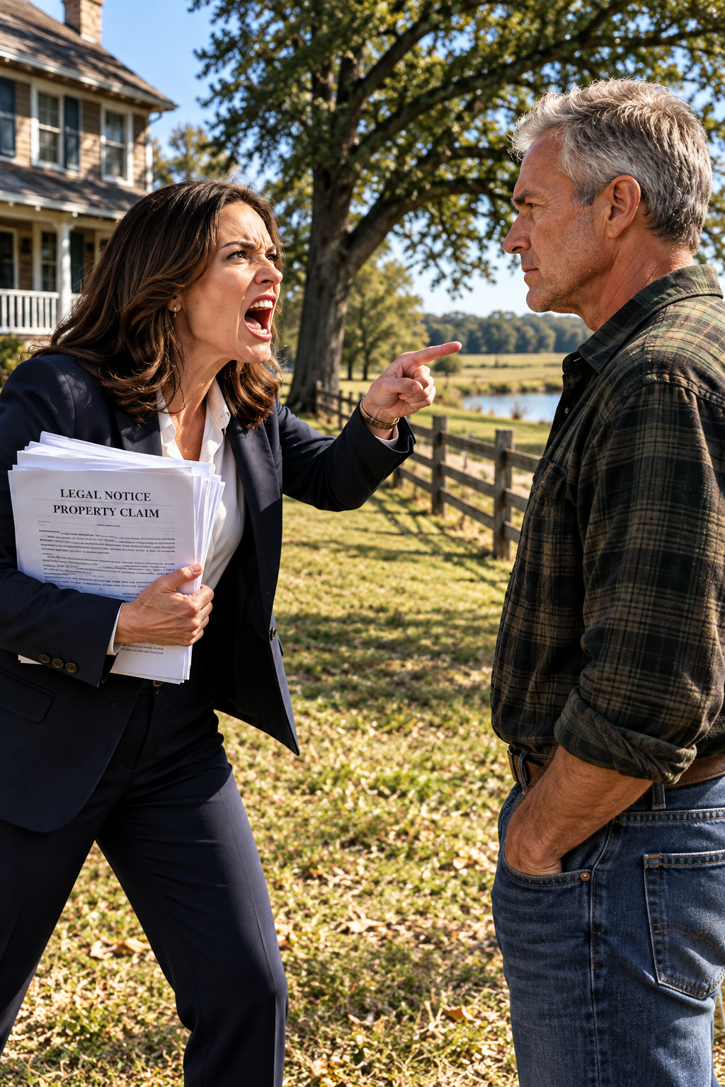
Part 2: The HOA president turns a disputed map into a public ultimatum
Diane had once worked in marketing and now treated the HOA presidency as a platform for commanding the neighborhood. She spoke often of community standards and collective well-being, but residents knew the practical meaning of those phrases: warnings, fines, and demands about fences, lawns, and paint colors. Some homeowners had learned to comply before she finished asking. Walter had read the association’s bylaws and knew their reach was limited. He had received letters, but he had never agreed to let the HOA govern his property. That difference mattered to him, even when it made him unpopular.
Diane’s presentation looked convincing to people unfamiliar with land records. The papers included a boundary map with a thick red line, a list of what she called corrected coordinates, and signatures she said belonged to county officials and the HOA’s legal team. She told the meeting the error had been discovered during a routine review of subdivision records. She said the HOA had tried to work informally with Walter, and now it needed to formalize the correction. Her delivery was smooth enough that challenging it felt impolite. Walter studied the pages and noticed that confidence had taken the place of explanation.
In the weeks after the meeting, a few neighbors who had once greeted Walter began to avoid him. One crossed the street instead of stopping to talk. Another suggested it would be easier to let the HOA handle the issue. Walter understood why people hesitated; no one wanted to be seen taking the wrong side of a dispute that seemed to have already been decided. He did not take the distance personally, but he did recognize the pressure behind it. He went home, made coffee, and began gathering the records that would tell him whether the map was real.
On a Wednesday morning before seven, the deep rumble of tracked machinery reached his bedroom. Walter looked out and saw a yellow excavator turning through a gap in his fence. The section had been pulled apart overnight, and two workers in orange vests were walking behind the machine with survey stakes. Diane arrived in a white SUV, wearing a blazer and holding her clipboard. She began directing the crew toward the disputed corner as if she had rehearsed the scene, while Walter came out in work boots and a flannel shirt, his coffee mug still in his hand.
He told them to stop, and the excavator idled. Diane said the HOA board had approved development of the corner as community green space at a meeting Walter had not attended. She handed him a second set of papers and advised him to pursue legal remedies if he had concerns. Then she lowered her sunglasses and repeated the invitation: “Go ahead and investigate.” Walter knew a lawyer would matter eventually, but he wanted to understand what the records actually showed before he filed anything. He drove to the county recorder’s office as soon as it opened.
Part 3: Old survey records reveal that the boundary was quietly changed
At the recorder’s office, Walter requested the original subdivision plat, all recorded easements, and every amendment associated with his parcel number. A clerk named Doris located what she could and sent for older maps from archive storage. She mentioned that the subdivision maps had been requested before, more often than she would expect. Walter returned the next morning to review the archived material, then visited the assessor’s office, the local history room, and an old surveying firm that still retained records from decades earlier. He wrote document numbers and observations in the small spiral notebook he had used throughout his engineering career.
On his fourth day of research, Gerald Wyatt, a retired surveyor who volunteered at the mapping office, paused beside Walter’s table. The older man looked at the maps, asked which property Walter was studying, and grew quiet when he heard the answer. Gerald recalled that the coordinates for the subdivision’s southwestern corner had been revised at some point. He had once questioned whether the original stakes and the new coordinates aligned, but someone had told him the issue was reviewed and corrected. The answer had never fully satisfied him.
Walter asked Gerald to sit down with him and compare the original plat against Diane’s revised documents. They met Thursday afternoon with the county records spread across a table. The original boundary line did not match the new one. Once the maps were aligned, the difference was clear: the original survey placed the southwestern corner of Walter’s property about forty-two feet farther into what Diane now called HOA common ground. That shift covered exactly the quarter acre she intended to take, including the pond’s edge, the fence, and the two white oaks.
Gerald explained that a legitimate coordinate correction required a certified resurvey by a licensed professional, followed by a formal amendment recorded through the proper county process. The revised document referenced no certified survey, carried no licensed surveyor’s seal, and cited only an “internal review.” Walter searched for a matching public hearing or county meeting and found none. The record had been quietly updated sometime within the last seven years, with no trace of the process that should have supported it. One signature belonged to a man who had briefly served on the HOA’s administrative board before resigning. The other had been written so poorly that Walter could not identify it.
He photographed every page and wrote down its document number. He made paper copies of what the county would provide and backed up the images in separate places. The discovery did not make him feel relieved. It sharpened his attention. The altered boundary explained Diane’s claim, but it did not explain who had changed the records or why. Walter drove home with his notebook on the passenger seat, already wondering whether the same method had been used anywhere else.
Part 4: A single false line begins to expose a larger land scheme
Once Walter understood what the altered notation looked like, he began recognizing it elsewhere in the neighborhood’s records. A parcel two streets away had become an HOA green space three years earlier. A narrow strip on the northern edge had been fenced off as a maintenance corridor, even though Walter could find no board vote authorizing it. Another former private lot now held HOA mowers and a trailer behind a locked gate. Each record contained the same vague reference to an internal review, and none pointed to a certified resurvey.
He gathered the ownership histories and transfer records for every parcel the HOA had claimed or developed during the previous six years. He compared original owners, tax records, recorded deeds, meeting minutes, and the dates when coordinates changed. At his kitchen table, he built a spreadsheet one row at a time. Some properties had become amenities: the community park, a pond access point, or landscaped corridors residents used without asking how the HOA had acquired them. Other entries raised harder questions. Two parcels appeared to have been sold to private buyers, yet the sales were missing from the HOA reports and treasurer statements Walter could find.
For three evenings, Walter worked through the records with his pencil beside the laptop. The pattern was not a collection of clerical mistakes. The HOA had repeatedly used questionable boundary revisions to claim land it did not own. Some of that land had been developed; some had been fenced or repurposed; two parcels had been transferred. The amounts paid in those sales were substantial, but the proceeds were absent from the association’s financial records. Walter began a separate file organized by parcel, date, and document type, and he kept his discovery to himself.
The HOA answered his inquiries with new pressure. Three fine notices arrived within two weeks, including one for the damaged fence that HOA workers had pulled apart. Another claimed the old horse barn needed HOA approval to remain standing, despite no such requirement in the bylaws. A third cited grass height on a day when rain had kept the entire neighborhood from mowing. Then the shared irrigation system serving the strip near Walter’s front boundary was shut off, followed by a letter saying his account was under review.
At a community meeting Walter did not attend, Diane described an unnamed resident as noncompliant and accused him of spreading misinformation about the HOA’s records. She said the association would remain committed to transparency and would not be deterred by bad-faith actors. Neighbors later repeated the speech to Walter with expressions of embarrassment and uncertainty. Marcus Webb, who lived three houses away, did not repeat the rumor. He told Walter he did not believe a word of it and asked what he could do to help.
Part 5: A neighbor’s drone captures work the HOA never disclosed
Marcus had a small business taking aerial photographs for real estate listings and owned two commercial-grade drones. He understood the basics of land surveys and, more importantly, knew how to keep quiet while gathering information. Walter asked whether he could document the HOA’s common areas and disputed parcels as they existed on the ground. Marcus agreed. For two weeks, he flew the routes at different times of day, recording fence lines, roads, equipment, grading, and the activity near the northern lots.
The images showed more than Walter expected. The HOA was clearing and grading areas that had not appeared in public meeting agendas or the records he had reviewed. Two lots on the northern edge still appeared to belong to private homeowners, but equipment moved through them early in the morning when few people were outside. New stakes had been driven into the ground along lines that did not match any easement or common-area boundary. Marcus tagged the footage with GPS coordinates and timestamps. He stored a copy at his own house, a precaution Walter suggested because he did not know how the HOA might respond.
Meanwhile, Diane moved closer to the vote she wanted. She called a formal meeting to consider acquiring the Greer parcel as a community green space and pond access area. The agenda had been distributed ten days in advance and described the proposal in polished language about community benefits and property values. Diane had already spoken with the board members she needed to support the motion. She expected a procedural meeting, one where the room would follow the agenda and move forward before anyone had time to ask difficult questions.
Walter received the notice and decided to attend. He arrived twenty minutes early with a leather folder and sat near the back. Marcus took a seat two chairs away, carrying the flash drive with the aerial footage. Several neighbors noticed Walter and looked away. Diane came to the podium, opened the meeting with practiced efficiency, and moved through the minutes, a brief treasurer’s report, and routine maintenance items. Then she introduced the proposed acquisition, describing it as responsible development and an enhancement to the neighborhood.
When Walter raised his hand, Diane allowed him two minutes to speak. He stood, carried his folder to the front, and connected a laptop to the portable projector Marcus had helped set up earlier. He had printed the original plat and the revised map at the same scale, mounted on foam boards. Every supporting record was indexed by date and parcel number. He did not begin with an accusation. He began with the original survey line and showed the room where the boundary had stood when the subdivision was first recorded.
Part 6: Walter’s presentation turns the HOA meeting into an investigation
Walter explained the difference between a legitimate survey correction and the vague notation used in the revised record. He showed the dates when the coordinates changed and compared them with the HOA’s development projects. In every case he could trace, the record change came before the work, not after a discovery on the ground. He identified the parcels that had been claimed as common space and the people who had owned them originally. He showed the records of two transfers and pointed out that the HOA’s financial disclosures contained no account of the proceeds.
Then he played six minutes of Marcus’s aerial footage. The room watched equipment move across northern lots that should have been private, while GPS coordinates appeared along the bottom of the screen. Walter placed the two full-size maps side by side, aligned their edges, and stepped back. For twenty seconds he said nothing. The room had gone quiet, but not from boredom. People were looking at a difference they could see with their own eyes.
Diane left the podium and crossed her arms. She said the documents were incomplete and that Walter had misunderstood the records. She promised to provide proof of a legitimate review process at a future meeting. Her voice stayed smooth, but the room no longer seemed to belong to her. Before she could finish, Raymond Cho stood from a chair along the side wall. He had served as an HOA administrative volunteer for two years before leaving eighteen months earlier.
Raymond said he had been present when the coordinate revision was requested. It had not come through a formal county review. He had been told it was a technical correction that had already been approved and that he only needed to process the paperwork. He said he had trusted the person who asked him to do it, and that he had regretted his decision ever since. Then he apologized. The room remained silent. At the back doorway, an attorney in a dark suit introduced himself as a representative of the county district attorney’s office.
The attorney said the office had received concerns about property records in the subdivision and had reviewed materials Walter provided. He said investigators had questions for the board and recommended that the meeting adjourn. No one called for the vote Diane had prepared. The meeting ended without the land transfer she wanted. Walter packed his maps, while neighbors stood around the room trying to understand how long the records had been wrong. The investigation that followed would last eight months, and the county would not rely on Walter’s work alone.
Part 7: Independent surveys confirm the HOA claimed six parcels
The county hired an independent certified surveyor to examine the original plats, the revised coordinates, and every intermediate document in the record. The report was clear: the boundary revisions lacked a certified resurvey and did not follow a legitimate review process. The altered records had supported HOA claims to six parcels totaling just over two acres beyond what the association actually owned. Two parcels had become amenities; others had been used for storage or incorporated into common areas. Two had been sold to private buyers.
Financial investigators subpoenaed the HOA’s accounts and traced the two sale proceeds. The combined total, $1.34 million, did not appear in the HOA’s financial disclosures, reports, or meeting minutes. A forensic accounting review found unexplained expenditures and transfers in the general account over four years. Walter had uncovered a serious boundary fraud, but the inquiry was now about more than his land. Homeowners learned that parts of their properties could have been affected by the same records. Some hired their own attorneys and began civil actions to recover their boundaries.
The HOA’s bank accounts were frozen while the investigation continued. All members of its administrative board resigned within three weeks, though their explanations varied. Some said they did not want to distract from the inquiry. Some admitted they had failed to ask enough questions. Others disappeared from meetings and common spaces without saying anything. Diane hired a defense attorney and continued to insist publicly that the records had been misinterpreted and that the HOA had acted in good faith. But she stopped appearing at neighborhood events, and people who had once been close to her began keeping their distance.
Four months into the formal inquiry, investigators submitted their findings to the district attorney. The charges included fraudulent alteration of official property records, misappropriation of funds under fiduciary duty, and unauthorized transfer of real property. Diane made no further public statement after the charges were filed. The criminal case proceeded alongside the civil disputes brought by homeowners whose boundaries had been altered. The process was slow, requiring certified surveys, financial audits, and hearings, but each new report reinforced the same central finding.
By the time the independent surveyor finished mapping every affected boundary, eleven households had been identified. Their original property lines were restored through certified surveys paid for by the HOA’s liability insurer. The two buyers who had unknowingly purchased the transferred parcels were treated as victims rather than participants. Settlements allowed them to keep their properties while receiving compensation for the fraud they had suffered. The original owners’ boundaries were corrected, and the question of who had been responsible moved through the courts.
Part 8: The HOA’s records bring formal charges and dissolution
The legal proceedings that dissolved the HOA took place in a county courtroom on an ordinary Wednesday afternoon. There was no packed gallery and no press conference. Four attorneys sat at a table while a judge reviewed the documents and asked a few questions. Walter attended but did not make a point of being there. The hearing lasted less than half an hour. At p.m., the court entered the dissolution order, and the HOA ceased to exist as a legal entity.
Walter drove home through ordinary traffic, made himself a simple dinner, and sat on the porch with a cup of coffee. He listened to the white oaks move in the light wind. He did not feel a rush of triumph. The years of record searches, meetings, and legal proceedings had taken time, and the loss of his wife still sat quietly in the spaces around the house. But the land was no longer being claimed through paperwork he could not trust. For that evening, it was enough to sit outside without wondering what the next letter would say.
A new organization formed the following spring, built around the two common areas that had always belonged to the neighborhood: a small park near the entrance and landscaping along the main road. It was voluntary, with modest dues and bylaws reviewed by a local attorney. The founding committee included Marcus and two other homeowners. They asked Walter to serve on a three-person review committee for future boundary or property questions. He agreed. He had no desire to run the group, but he was willing to help keep its authority clear.
The neighbors returned gradually, one conversation at a time. Ted Halverson stopped by to return a wrench he had borrowed before the dispute and stayed forty minutes talking about the road project and lumber prices. Pam Hartley brought a warm casserole and apologized specifically for the moment she had doubted Walter. An older couple who had once supported the HOA’s claim later learned their own rear boundary had been moved and sent him a handwritten letter. Walter read it, folded it along its creases, and put it in the drawer with the deed and Carol’s death certificate.
He did not hold on to the resentment. At sixty-two, he understood the difference between remembering an event and carrying it everywhere. The fence still needed repair, and that was something he could do with his hands. His father had kept cedar posts in the barn for exactly this kind of work, stacked beneath canvas. Walter brought out the old post-hole digger, checked each hole to the right depth, set the posts, and used the same spacing block his father had used. On the third weekend, Marcus came over to help set the final six posts. They worked in comfortable silence.
Part 9: A new oak takes root where the old boundary was defended
When the fence was finished, Walter stood at the southwestern corner and looked at the two white oaks that remained. He thought about his father planting them, about Carol reading by the pond, and about the excavator that had sat on his land before dawn. The feeling that came over him was neither simple satisfaction nor complete peace. It was something quieter, earned by the work of putting things back in place. The original survey markers stood where they had always belonged, and the corner of the property was his again.
He decided to plant a new white oak midway between the two existing trees. He knew he might not live to see it reach their height; oaks took their time. But he wanted it to grow in line with the others, a living marker on a boundary his father had measured and that Walter had defended. He ordered a young tree from a native plant nursery, drove sixty miles to pick it up, and dug a hole wider than it was deep. He loosened the soil around the edges for the roots, tamped the earth gently, then carried water from the barn.
The tree was barely waist high, its trunk no wider than Walter’s thumb. He stood beside it for a while, feeling no need to turn it into a symbol. It was a tree in the ground where trees belonged. Behind him, the pond rested under the late-autumn light, and the old barn cast a long shadow over the grass. Around him, the neighborhood returned cautiously to ordinary life. There were no more meetings where someone claimed land with a red line and a confident voice.
The story of Diane’s downfall became a quiet warning, repeated when anyone suggested crossing a boundary or using the association’s name to pressure a neighbor. The HOA had not merely lost a dispute; it had been dissolved by court order after its records and accounts were examined. The survey markers stood where they had stood when Walter’s father placed them decades earlier. The new oak began its slow growth, and Walter continued his own quiet routines. He made coffee, walked the property, and worked on the small repairs that had always given his hands something useful to do.
He had been patient through a long career, through his wife’s death, through years of living alone, and through the months it took to put the record right. Patience, for Walter, had never meant accepting whatever someone else decided. It meant taking the time to learn what was true and being willing to stand by it. Diane had mistaken his quiet for weakness and his stillness for defeat. The altered maps had looked official until someone examined the original lines. The hidden sales had looked like ordinary transfers until someone asked where the money went.
That evening, Walter stood at the edge of the land his father had purchased and his family had loved. The fence was back in place, the oak sapling was set in the soil, and the property lines matched the original plat. The HOA that had arrived with fines, claims, and heavy machinery was gone. Walter held a cup of coffee that had grown cool in his hand and listened to the wind move through the trees. The land had always been his, but now the records said so plainly, and the quiet felt like his again.
✓ Lynn R. Adams
Part 2: The HOA president turns a disputed map into a public ultimatum Diane had once worked in marketing and now treated the HOA presidency as a platform for commanding the neighborhood. She spoke o…